Welcome to our site. The owner has his own business supporting Third Sector Organisations and writes and produces his own music
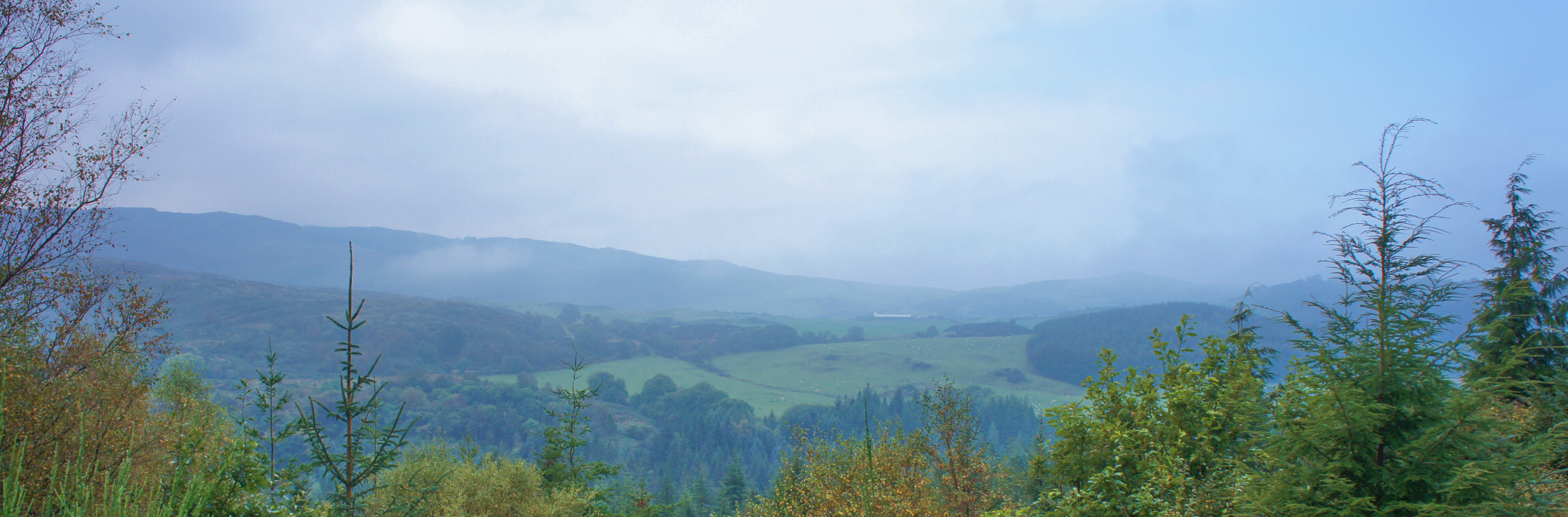
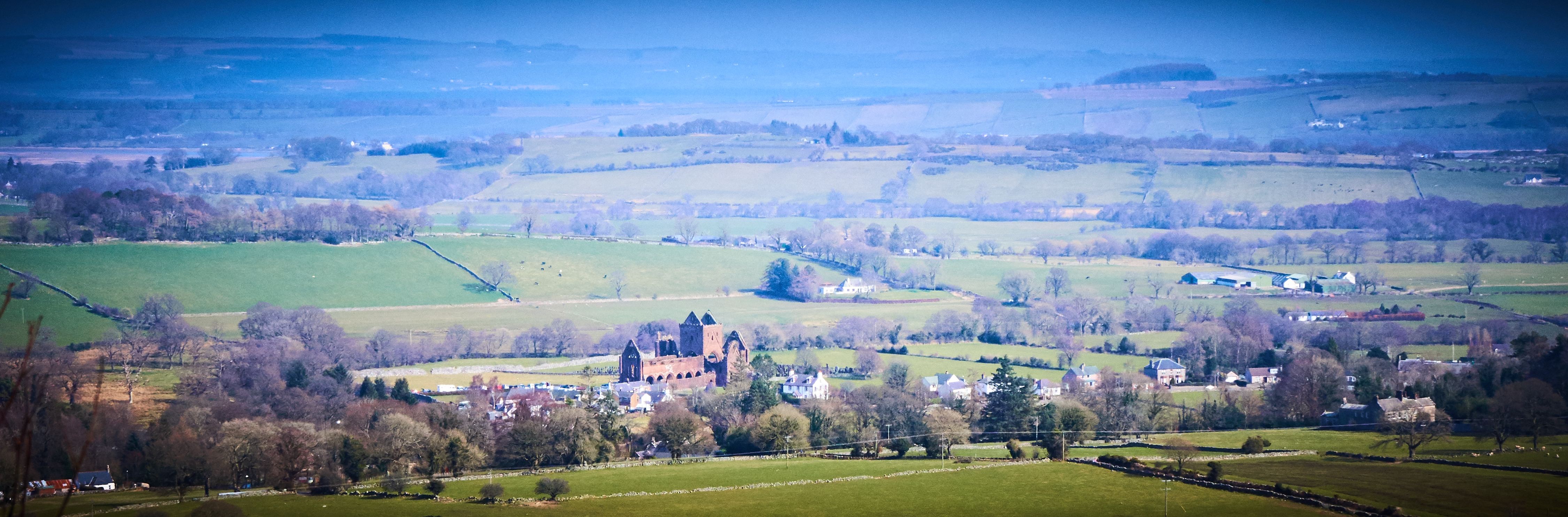
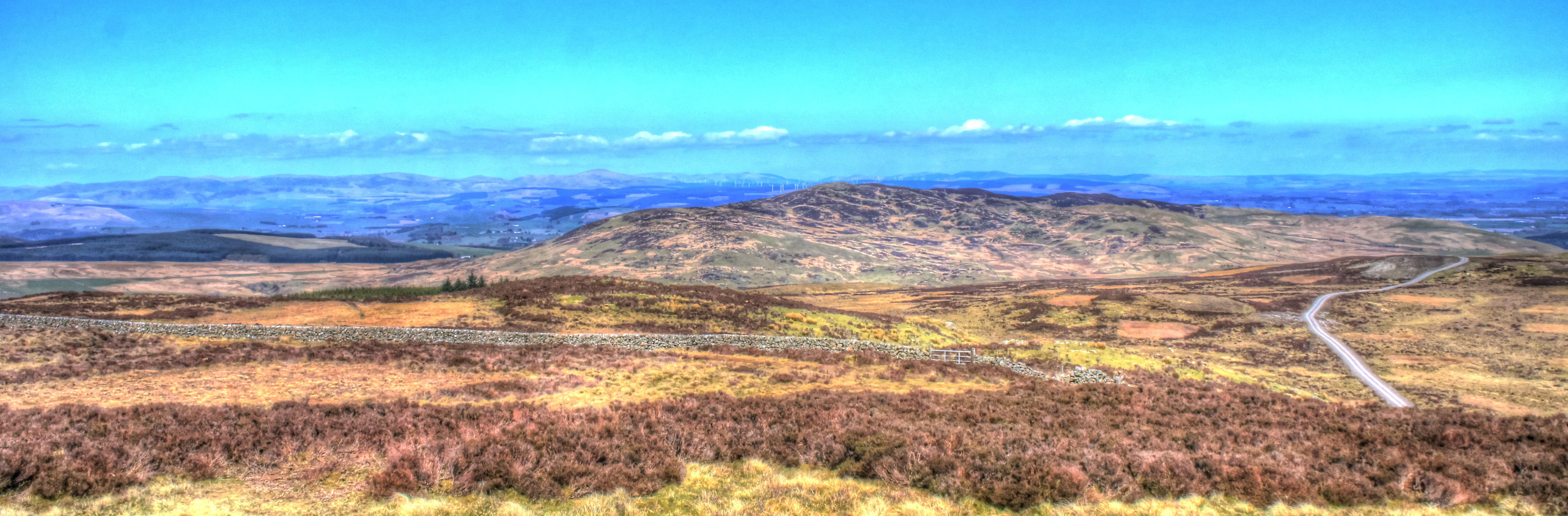
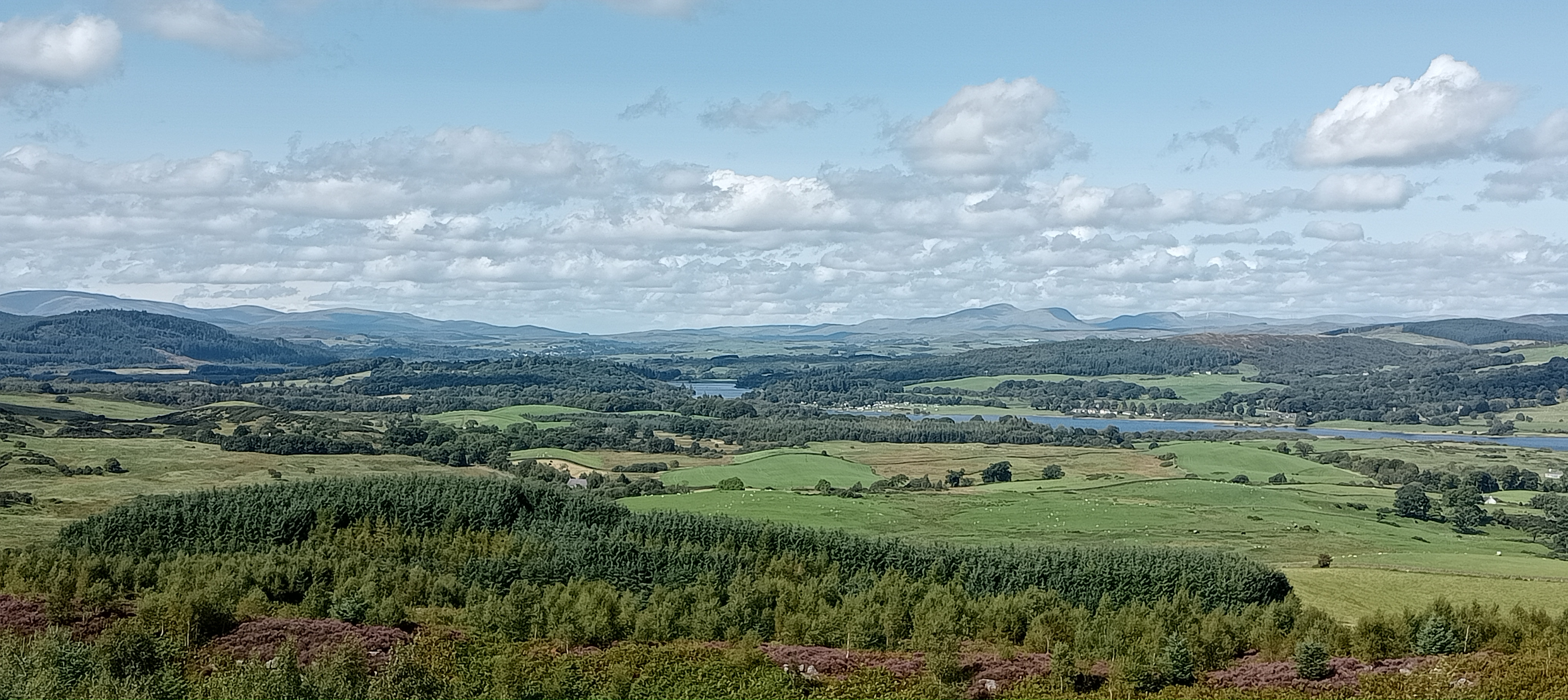
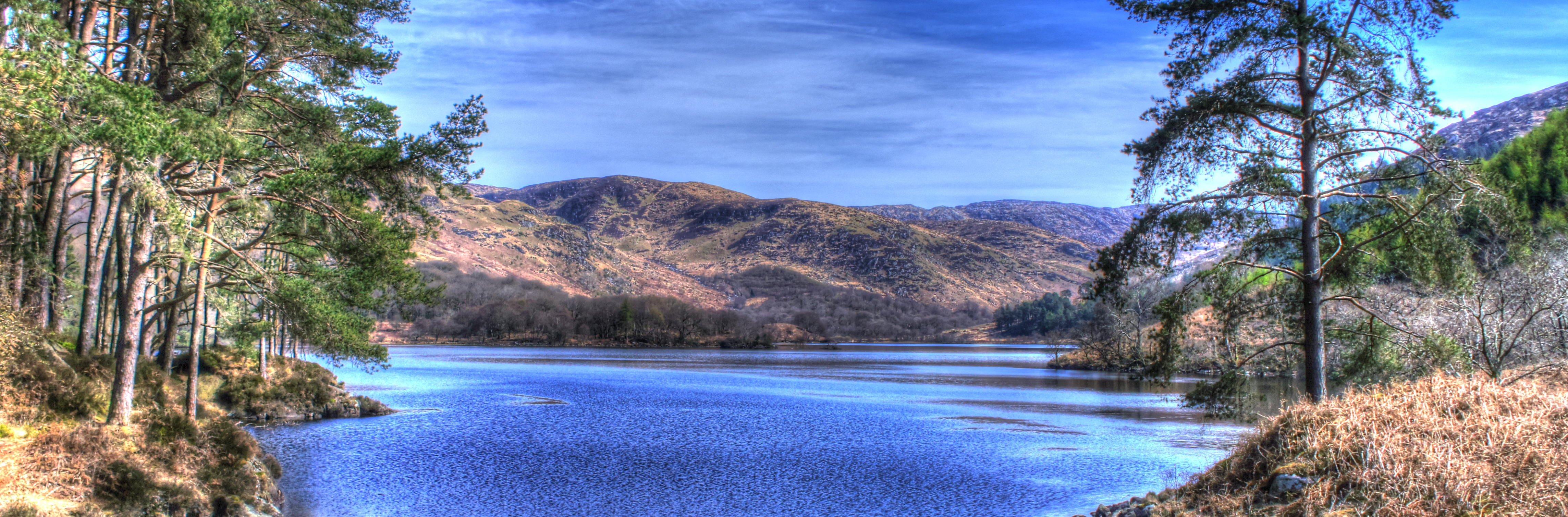
Some of the pictures you're seeing are from other parts of Scotland
Dalbeattie walks walking hiking
Walks in Dalbeattie Forest, Town wood, Munches, Solway Coast, Rockcliffe, Kippford, Galloway, Dumfries and Galloway, Glentrool, Screel
RESPECT LIVESTOCK, PROPERTY AND TAKE YOUR RUBBISH WITH YOU, SHUT GATES, KEEP DOGS ON LEADS IN FARMLAND AND OTHER AREAS
Downloading GPX tracks means you have the skills and knowledge to use them. Heading into the hills is always unpredictable and you should always have a map and compass and the skills and knowledge to use them too See the Mountaineering Scotland website for safety informationSome walks take you through Dalbeattie Town Wood, which is home to the 7stanes MTB tracks. You may encounter cyclists so take appropriate care. Dalbeattie Town Wood has lots of trails. All of them can be accessed from the car park located near the 30 MPH limit signs on the A710 junction with the High Street. Walks shown here that start from the central Dalbeattie Park, Colliston are shown to encourage walkers to make use of the many shops in Dalbeattie Town Centre. Great for picking up drinks and snacks before your walk, or for having refereshments in the welcoming cafés and pubs afterwards.
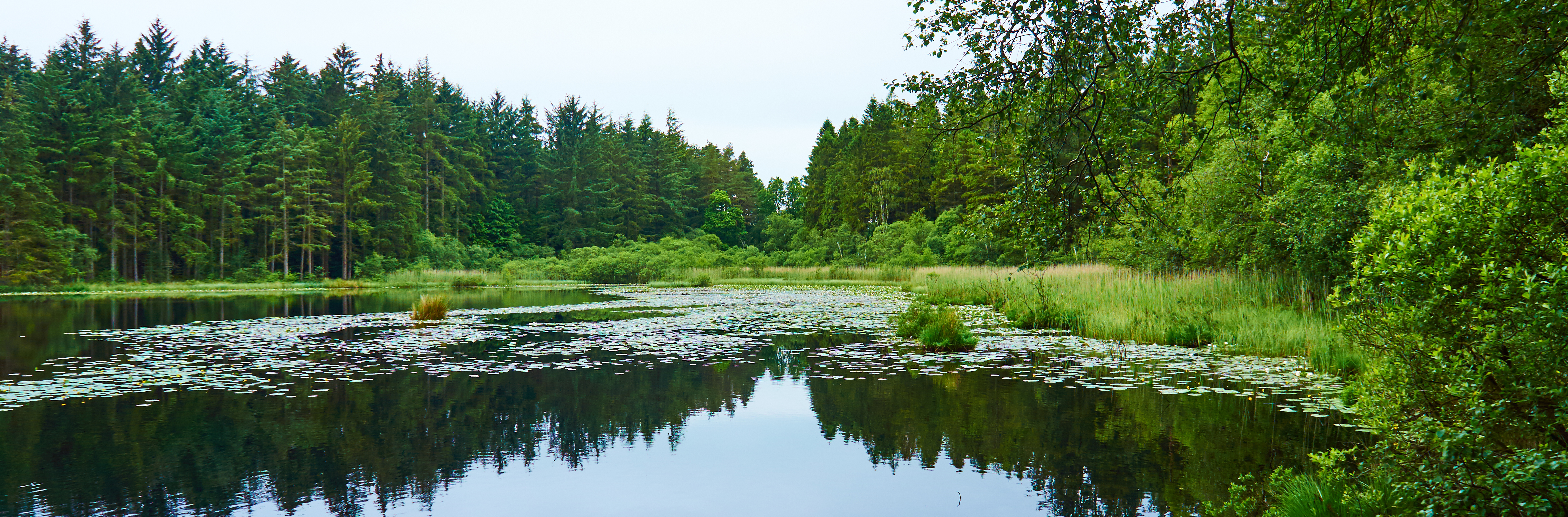
plantain loch from colliston park ~ 4 miles
This walk takes about an hour at a gentle pace but you may want to spend some time at Plantain Loch where there is seating and nice views of the wildlife on the loch. Plantain Loch is in what is locally known as the Town Wood and is well used by locals for dog walking, recreation and exercise. I recommend doing the walk anti-clockwise as you look at the image as the seating then comes in to play for a rest and maybe some refreshments! You should be able to see from the image there are variations of this walk, and in the Town Wood the Forestry Commission has three trails starting from the Town Wood car park.
Download the GPX file for this walk click to zoom - opens in new window
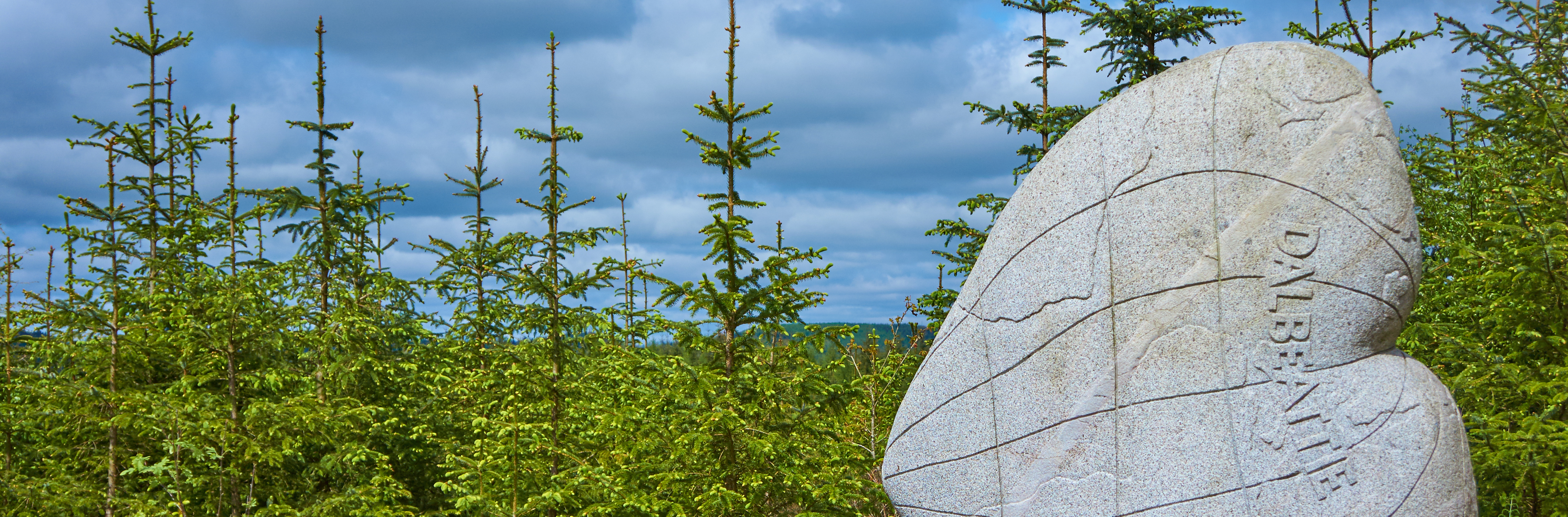
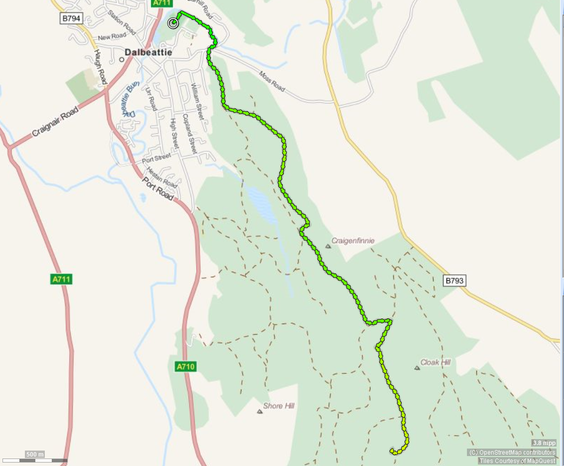
heart cleft stane from colliston park ~ 6.3 miles
This walk takes you from the Bandstand in Colliston Park
(two nearby carparks at the Town Hall and off John
Street {the Daniel}) and at a leisurely pace will take
around two hours to complete the round trip. Starting in
the Park the route takes you past the Dalbeattie Star
football ground alongside the Urr Water (also known as
Dalbeattie Burn) before passing the Primary School,
crossing Moss Road and entering Dalbeattie Forest at
Spycraig. The walk takes the red route at the
start of the Forest and once past Plantain Loch (to your
right) follows the Forest roads and tracks to the Heart
Cleft Stane.
Having arrived at the Heart Cleft Stane
you can retrace your steps or follow the cycle track to
the Moyle and back to Dalbeattie from there.
 click to zoom - opens in new window
moyle hill via heartcleft stane from colliston ~ 7 miles
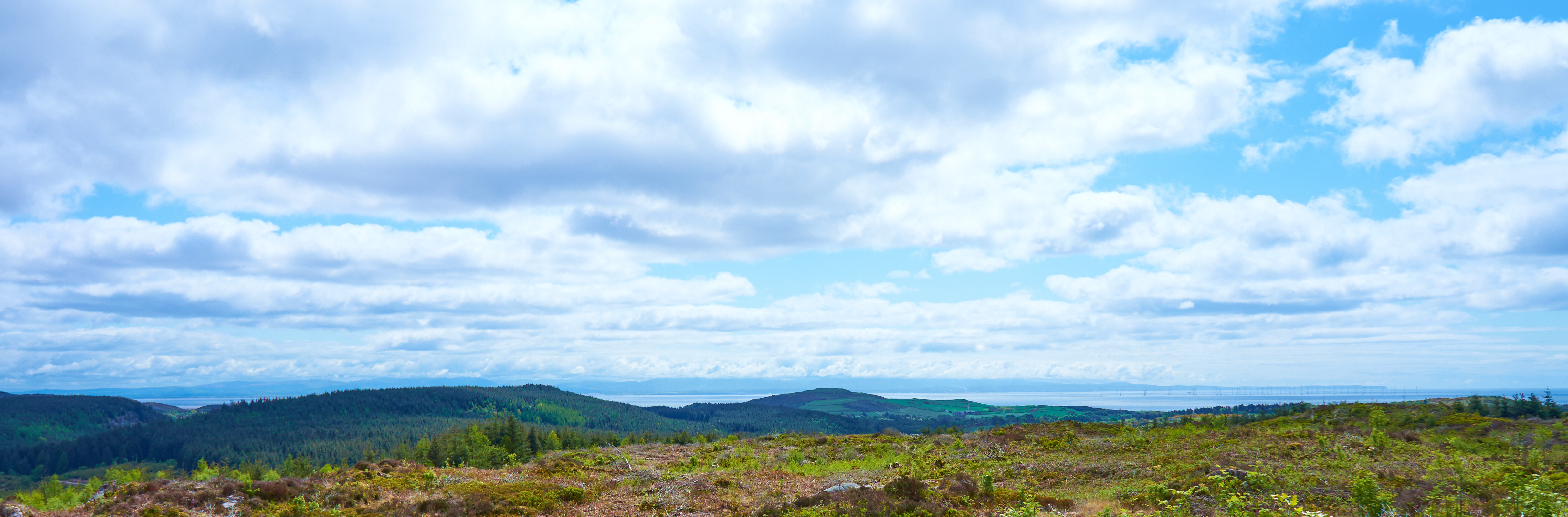
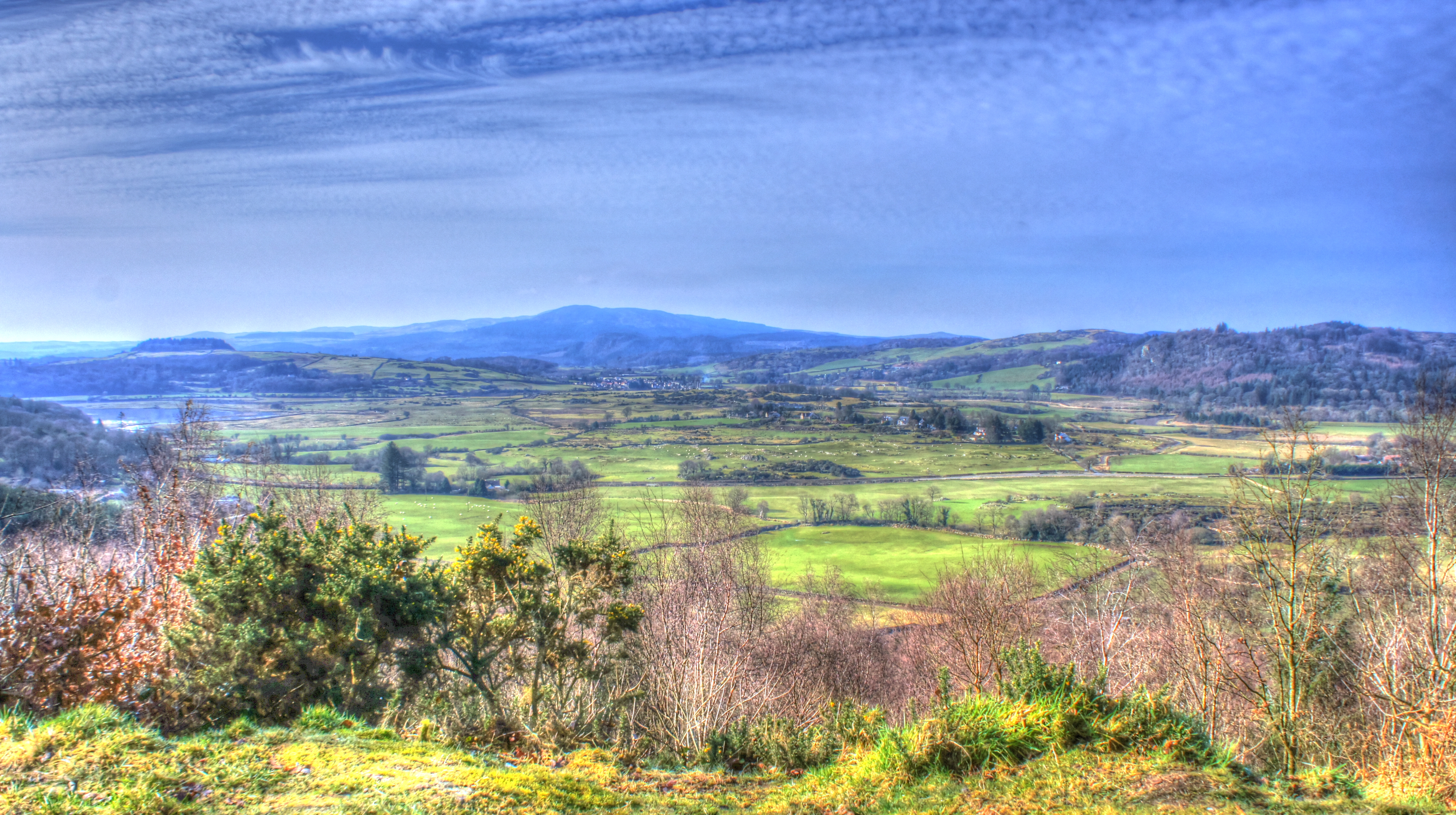
This walk - marked here in yellow arrows, continues the Heart Cleft Stane walk using the cycle track so take care to the junction with the path to Moyle hill. Depending how you feel you can turn left up the steep path to Moyle Hill or turn right down the steep hill to rejoin the main forest track that joins Dalbeattie to Kippford and Colvend and return to Dalbeattie (shown in blue) The short walk to Moyle Hill is steep, but if you are there on a clear day, the views are stunning. Both North to Dalbeattie and the Galloway Hills and South across the Solway Firth to the Lake District and everything in between.
Download the GPX file for this walk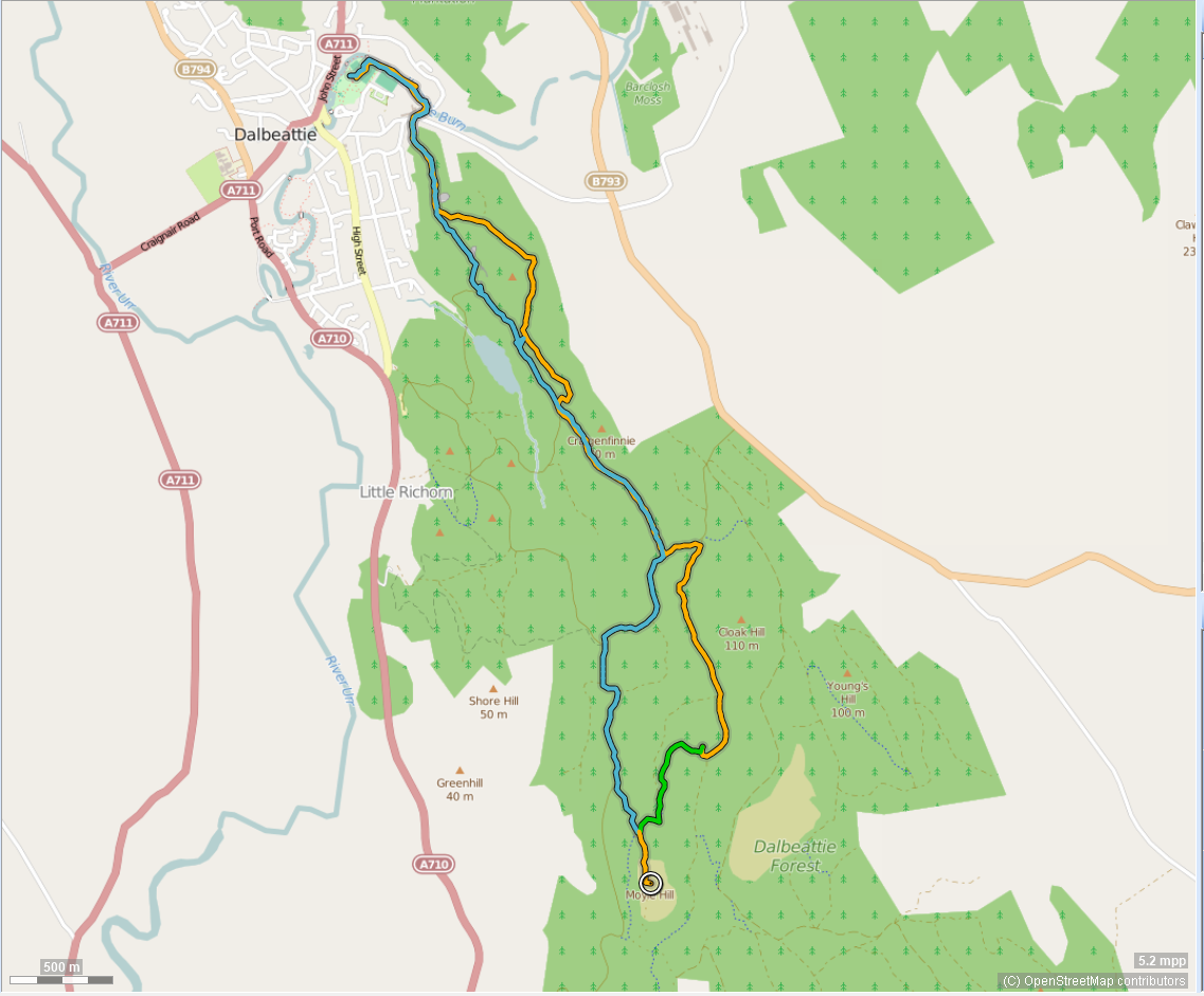 click to zoom - opens in new window
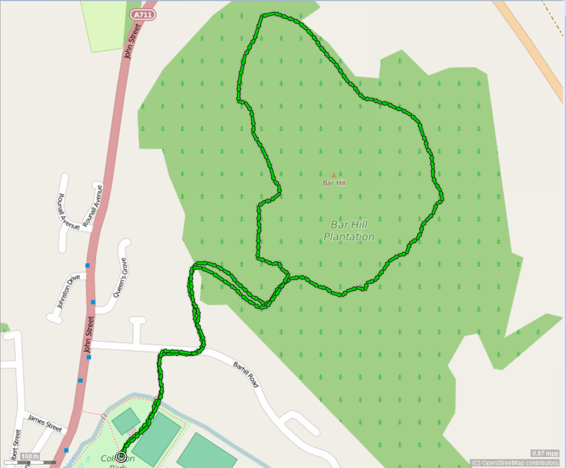
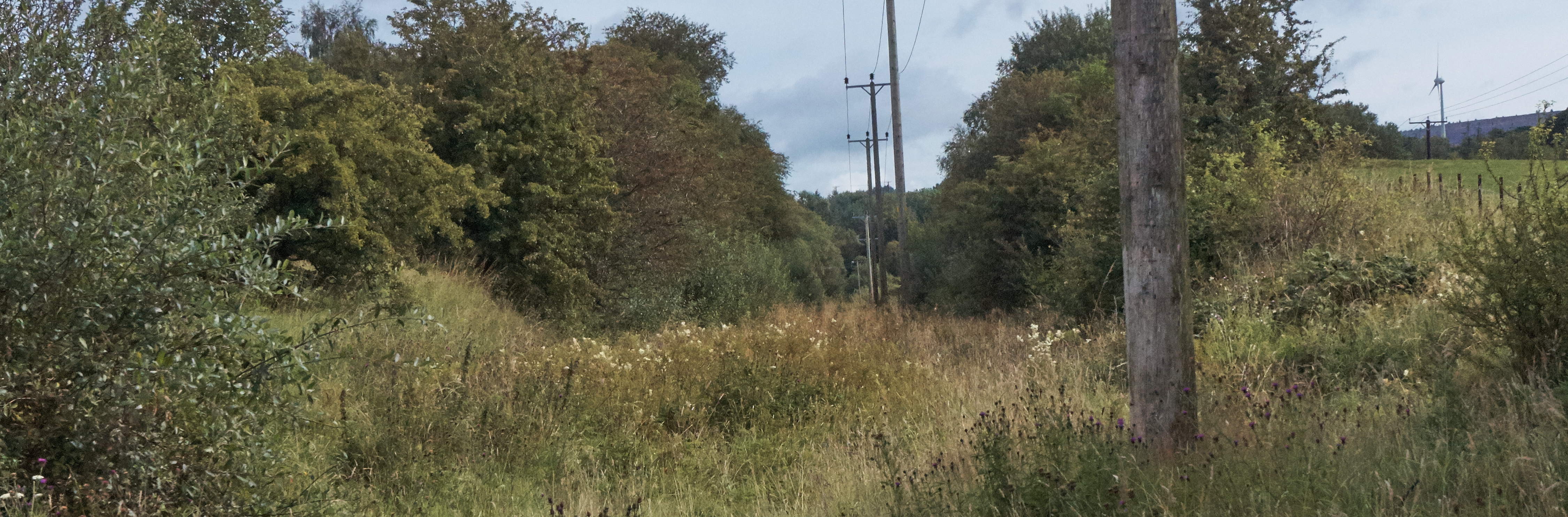
bar hill from colliston ~2 miles
This walk - is more of an "exercise" walk - there is
just one view, of Falgunzeon hills and that's quite
fleeting.
Having said that it takes you through some
lovely woodland and if you are patient you may well see
red squirells, deer and other wildlife.
The walk
takes about an hour and there is some elevation.
 click to zoom - opens in new window
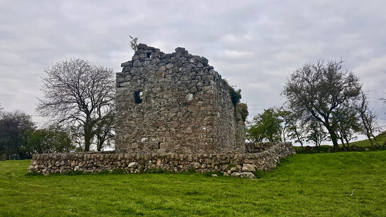
edingham castle from collistion ~ 2.2 miles
This relatively short walk takes you along the main road to Edingham. There is a short stretch where there is no path, and you need to cross a field to get to the Castle itself. It is however pretty much flat. If you like Castles, Edingham is small but interesting! Certainly worth a few photos. It is a "there and back" walk but you could carry on down the Caulkerbush road and head back to Dalbeattie via Moss Road. Or move on to the paddy's line walk below.
Download the GPX file for this walk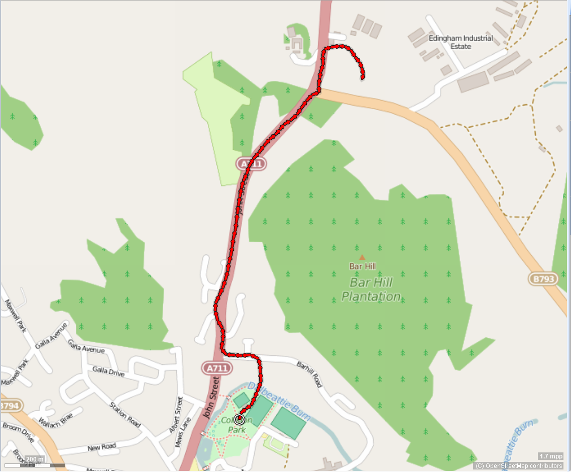 click to zoom - opens in new window
paddy's line ~ 3 miles
You can do this walk from Dalbeattie by using the Edingham Castle Walk first and either crossing the field to Edingham Industrial Estate or following the access road. If driving to the start, follow signs for Edingham Industrial Estate and please park safely. This is a relatively short walk along the old railway track know locally as "Paddy's Line". There are a couple of gates to climb and the red lined walk entails negotiating a fence, so this is not suitable for all walkers.
Download the GPX file for this walk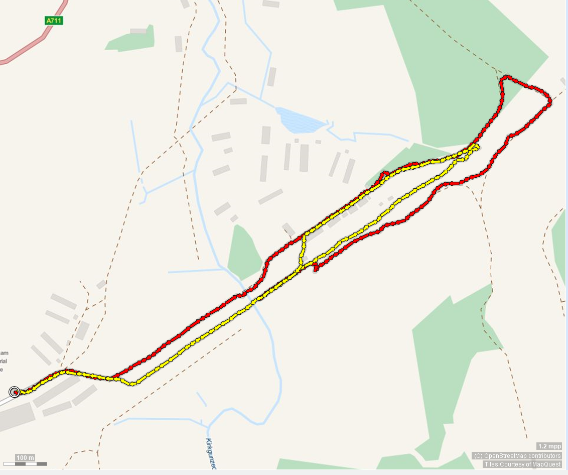 click to zoom - opens in new window
rounall wood ~ 1.5 miles
Starting from the Bandstand in Collistion Park, this walk takes about 30 minutes at a gentle pace and
takes in Rounall Wood. The wood is maintained by local
volunteers and skirts Dalbeattie golf club. In theory it
is accessible to all and I've seen mobility vehicles
several times but I've never done the walk with a
monility disabled person.
It's a pleasant walk well
used by locals and the loop shown takes in the wildlife
quarry. This quarry was gifted to the Town by the
Maxwells.
The walk to Dalmun is accessed from this walk
 click to zoom - opens in new window
_7)_8)_tonemapped.jpg)
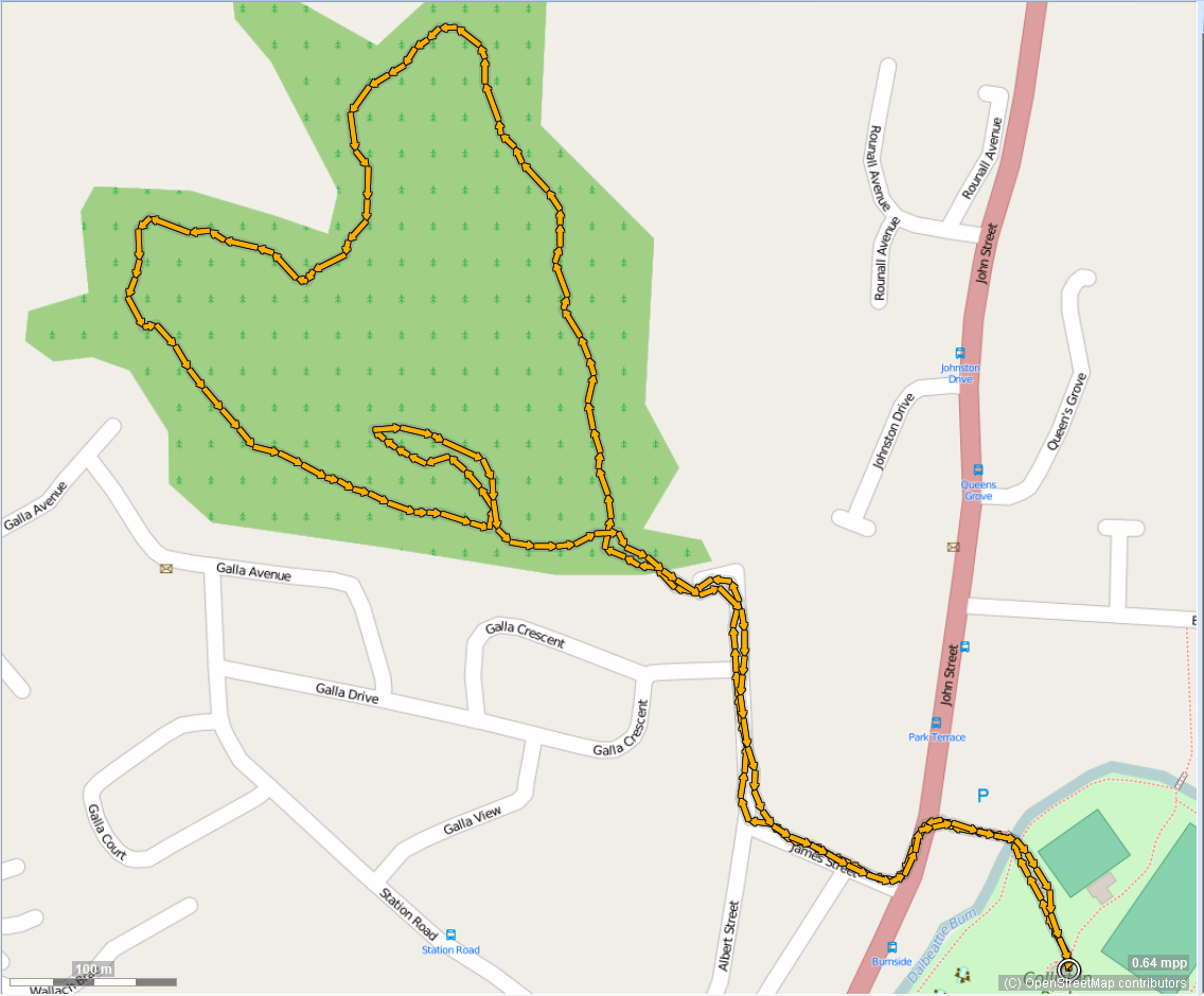
dalmun ~ 2.75 miles
You can either start from the Bandstand in Colliston Park from the walk above, or start from the small car pak sitauted to the left of the entry to Dalbeattie cemetery. Dalmun (the local name for Dalmoney Hill) has become a very popular walk, being central to Dalbeattie and offering outstanding views, weather permitting! Follow the path through Rounall wood and enter the golf course through the metal gate. The path is well-defined - watch out for golfers as you cross the fairway. The path climbs steadily as you go through signposted gates to the summit. Enjoy the views and retrace your path or take the detour shown, to the start.
Download the GPX file for this walk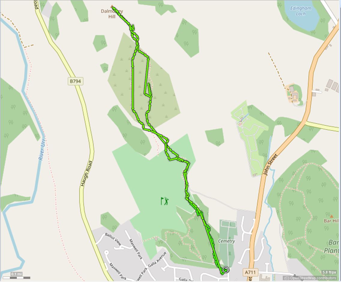 click to zoom - opens in new window
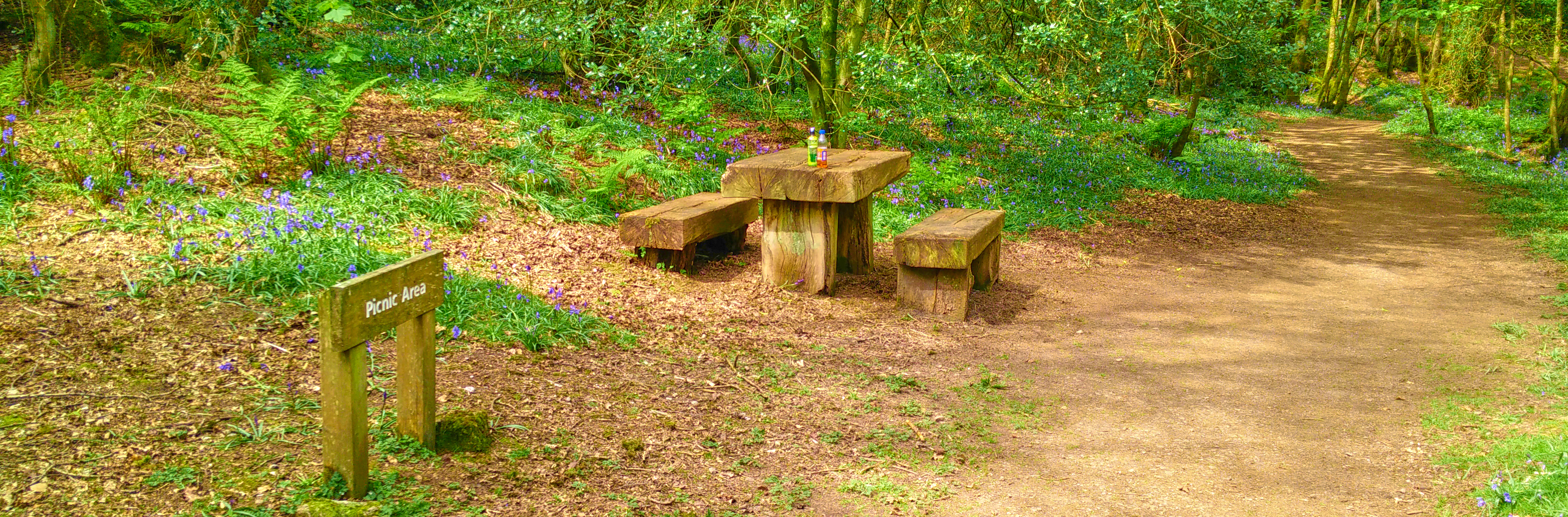
town wood viewpoint from car park ~4.5 miles miles
This walk follows the signposts for "Kippford/Colvend" and indeed can be continued to get to either destination. The viewpoint, on a fine day, offers lovely views across the Urr valley to Palnackie, the Munches, Screel and further. After a rest to have a picnic or snacks, the return journey makes this a relatively easy "circular" walk along forest roads. The route shown takes a detour on the outward trip via Woodhouse. Look out for the Woodhouse signpost after ~ 2 miles, turn right and immediately left onto the footpath.
Download the GPX file for this walk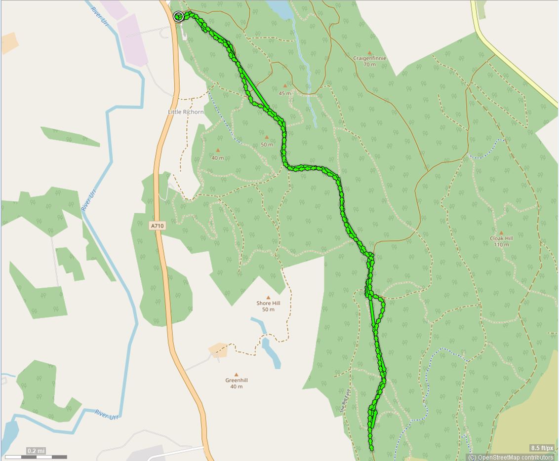 click to zoom - opens in new window
town wood loop 1 ~ 3 miles
Dalbeattie Town Wood has lots of loops. We'll add some more when we can. This one takes the forest tracks and can be extended around Plantain Loch or up to the Heartstane or further by combining with other walks on this page.
Download the GPX file for this walk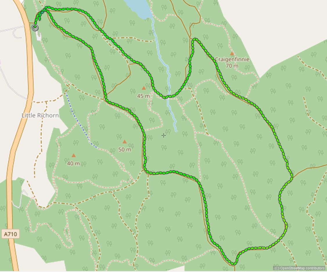 click to zoom - opens in new window
town wood loop 2 ~ 3 miles
This loop picks up the track to the East side of Plantain Loch. The GPX was a bit sketchy when I last did this walk so I'll re-do it.
Download the GPX file for this walk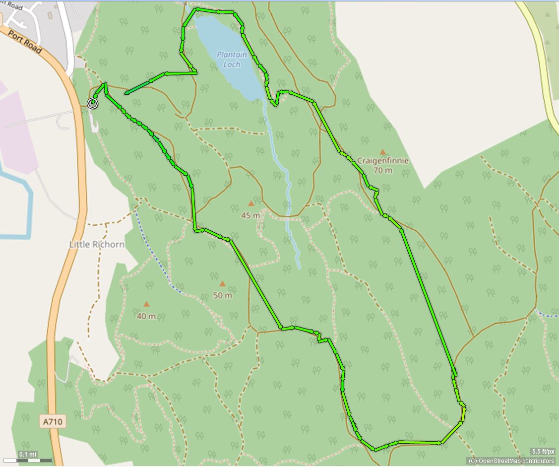 click to zoom - opens in new window
town wood loop 3 ~ 3.3 miles
This loop avoids Plantain Loch. I'm not suggesting you should avoid it... it's just that this loop does.Download the GPX file for this walk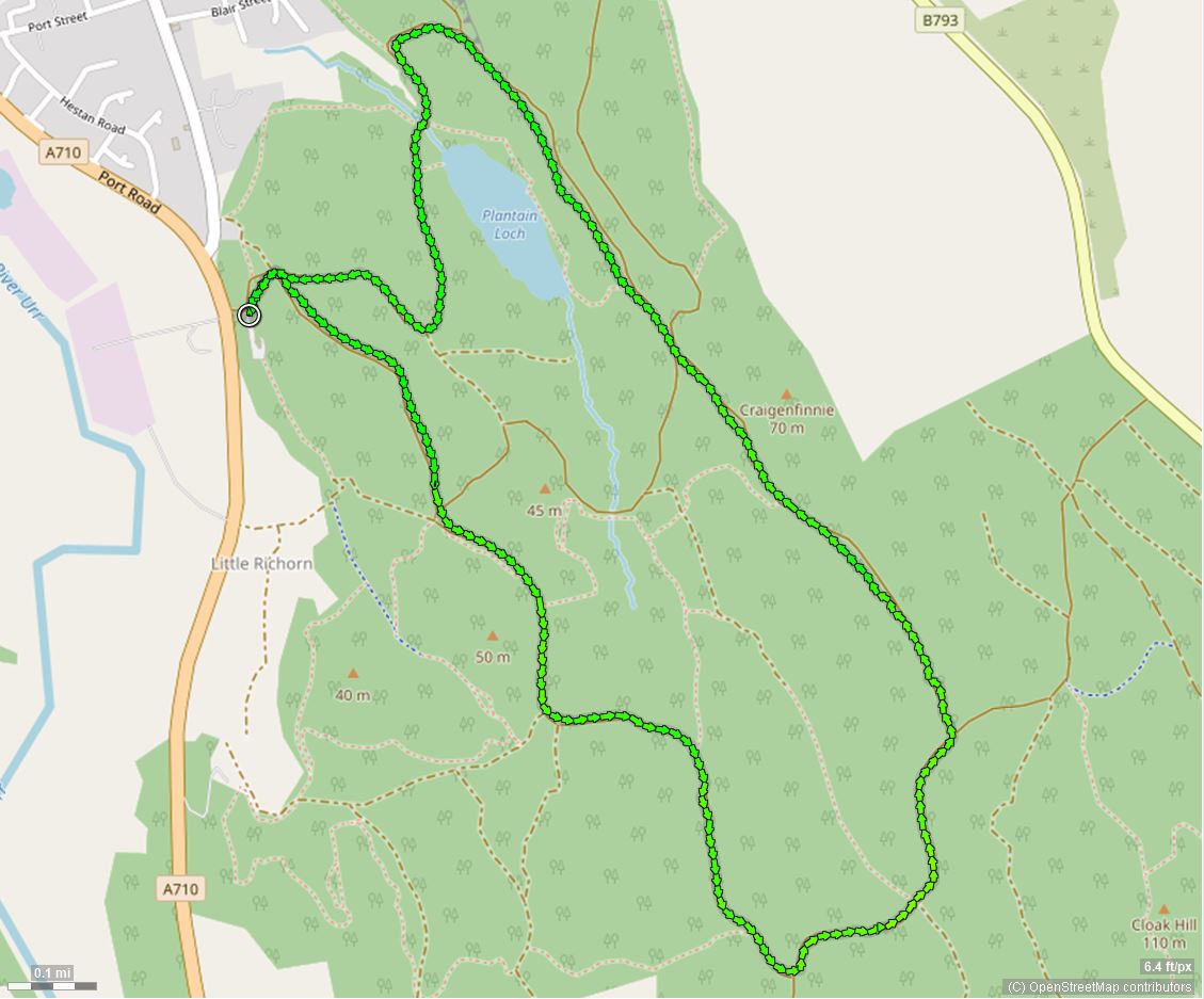 click to zoom - opens in new window
town wood loop 4 ~ 2.2 miles
This loop follows the paths and roads and is hopefully suitable for not just walkers but for those in motorised wheelchairs. I can't say for certain as I've not done the walk with a buddy in a wheelchair. Download the GPX file for this walkclick to zoom - opens in new window
town wood loop 5 ~ 2.5 miles
This loop picks up the higher path above plantain walk and makes a change from the forest roads. I've done this short walk many times but the GPX track never plots correctly! I;ll keep trying and maybe one day.. Download the GPX file for this walk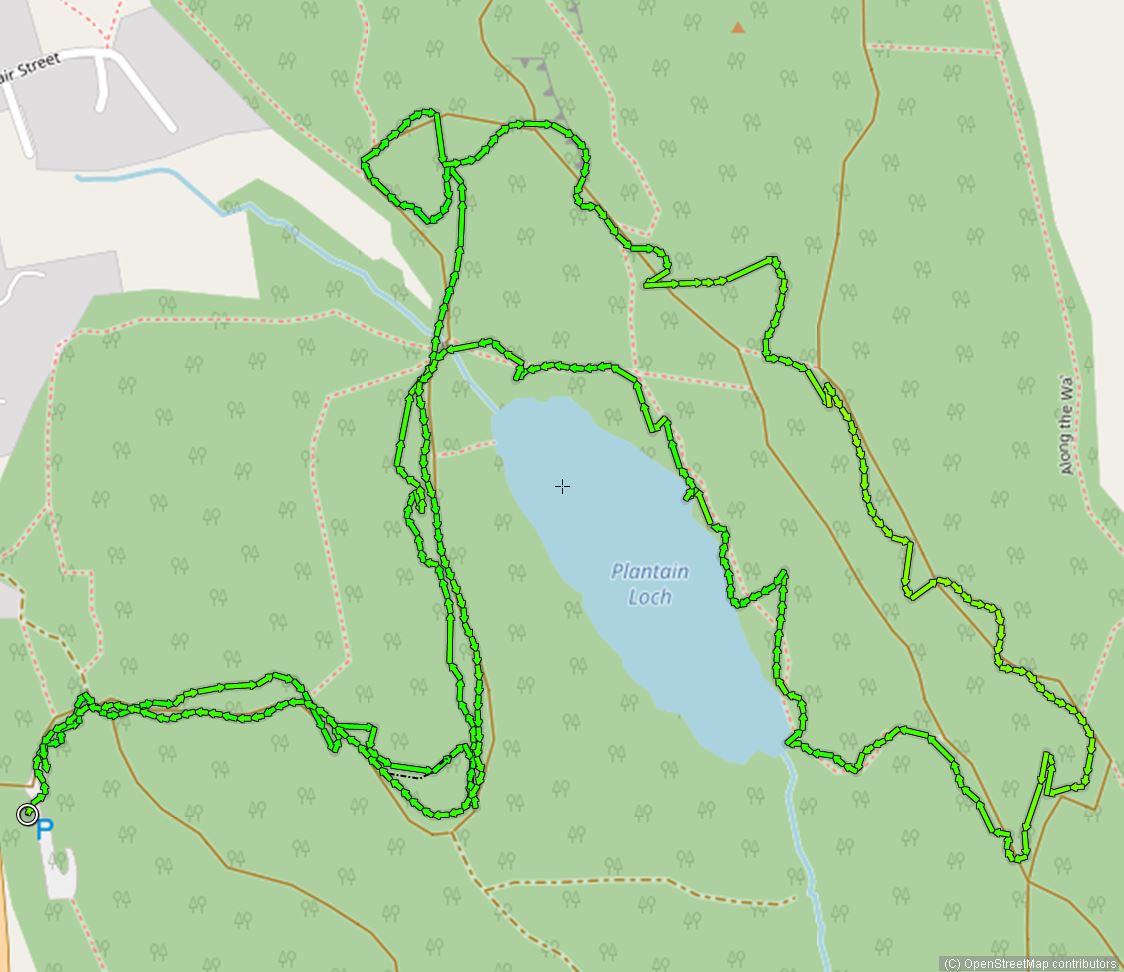 click to zoom - opens in new window
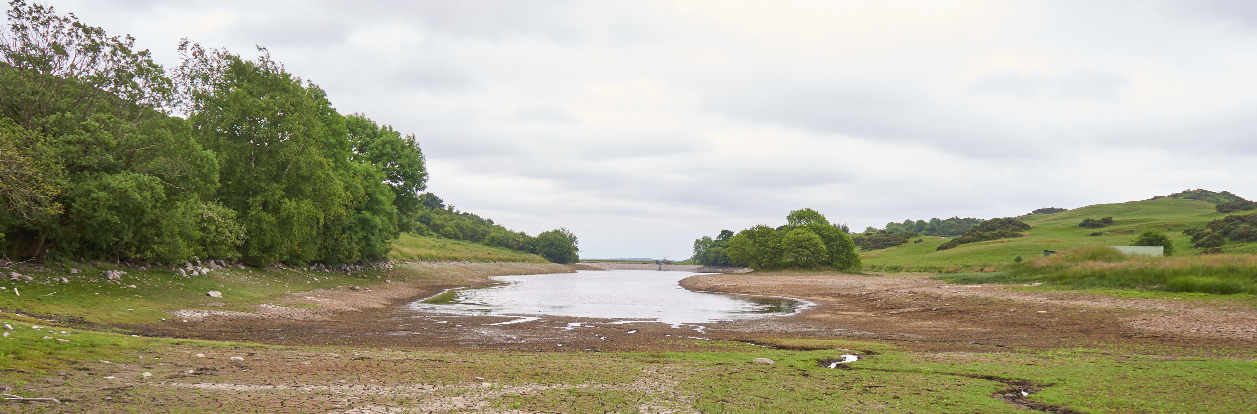
reservoir from quarry ~ 2.8 miles
This walk can be started at the Bandstand like others do, and that will add approximately 3 miles to the round trip. The walk as shown here starts at the Quarry "car park". Drive out of Dalbeattie towards Castle Douglas and at the trafflc lights take care and go straight over, up the Quarry access road. Follow up the hill until you see the open area opposite Butterhole Cottage. The walk is initially along a path climbing upwards through a metal gate into a field. Follow the wall still climbing and then drop down to cross the A745. TAKE GREAT CARE WHEN CROSSING THE ROAD. Follow the farm access road down until you come to the cottage on your left at a Y junction. Bear right and follow the farm track up, dog-legging left then right through two farm gates. Climb upwards along the farm road to the open field. Cross the field and you'll see the reservoir. Follow the paths anti-clockwise round the reservoir. You can follow the reservoir on the West side either inside or outside the dividing fence. If you choose the reservoir side, be careful near water. Retrace your steps to the Quarry.
Download the GPX file for this walk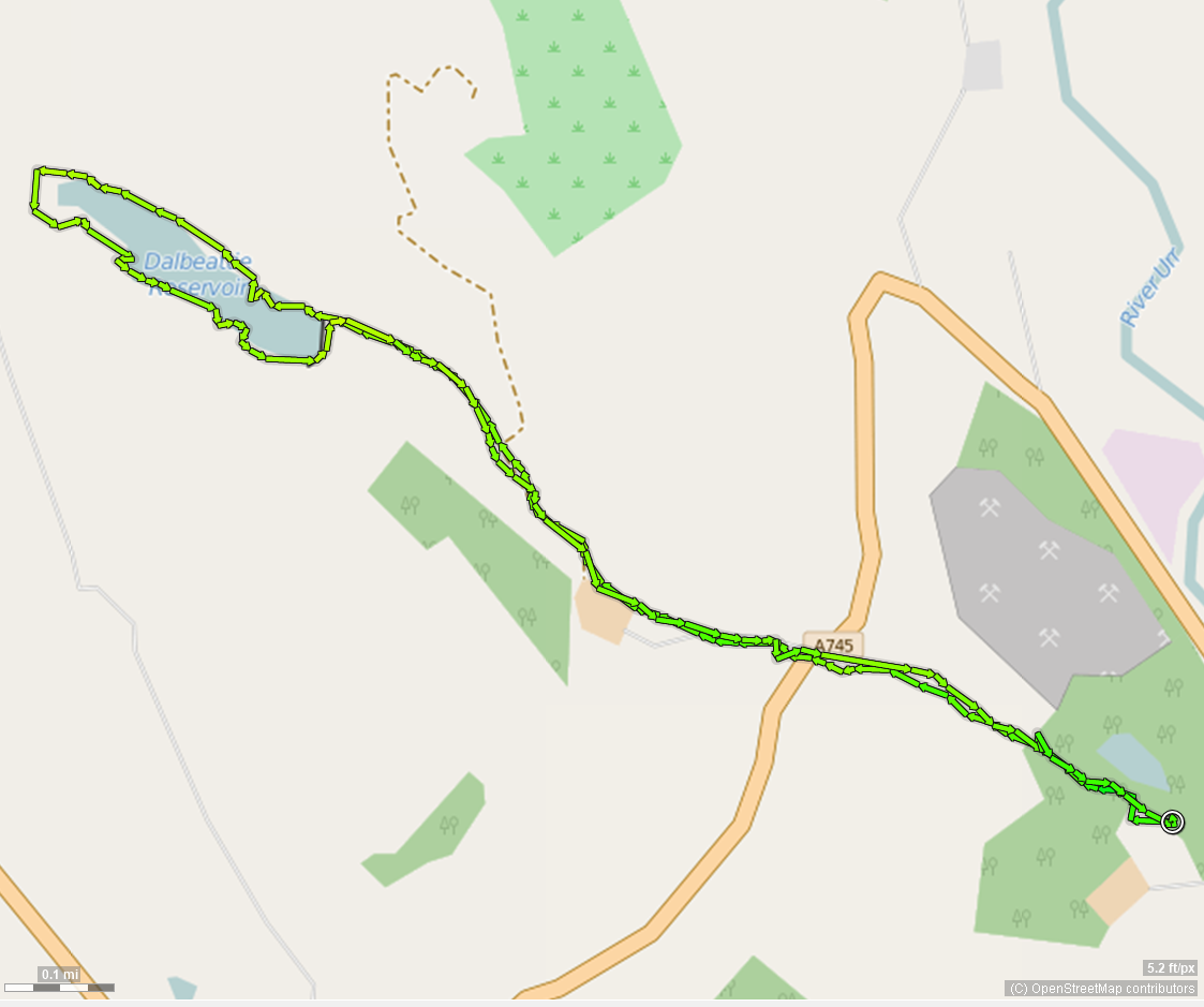 click to zoom - opens in new window
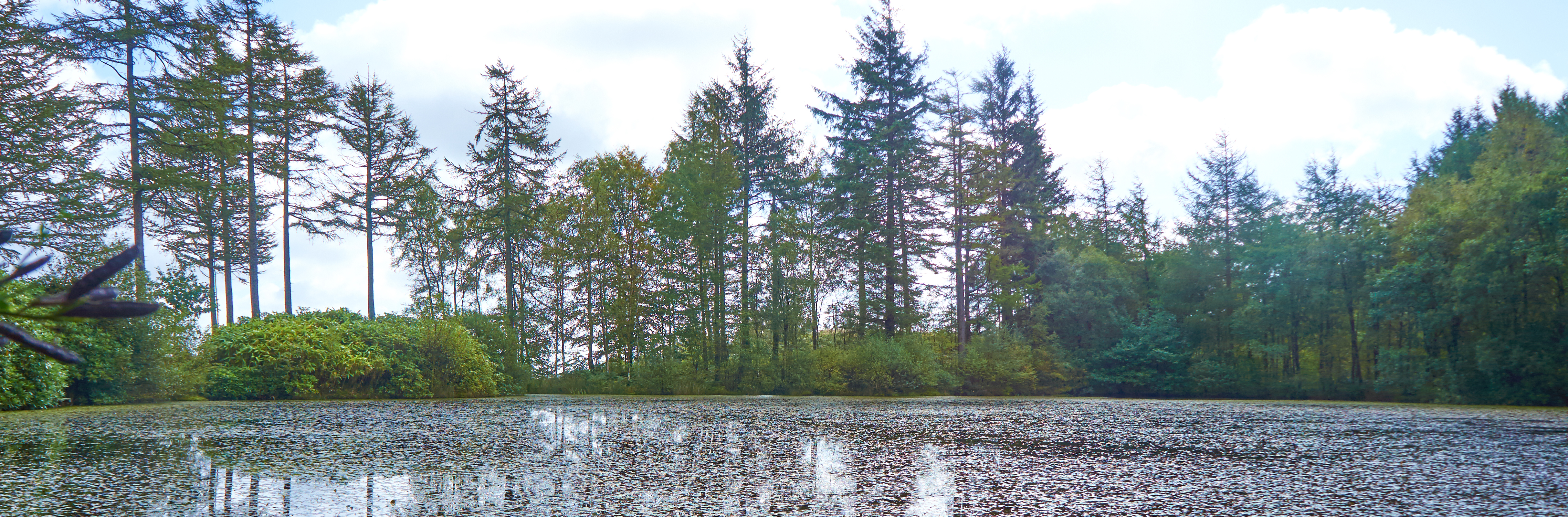
gavin's loch ~ 3.5 miles
This walk can be started at the Bandstand like others do, and that will add approximately 3 miles to the round trip. The walk as shown here starts at the Quarry "car park". Drive out of Dalbeattie towards Castle Douglas and at the trafflc lights take care and go straight over, up the Quarry access road. Follow up the hill until you see the open area opposite Butterhole Cottage. The walk takes you up Munches Hill, which is quite steep and there is not delineated path through the first fields. The first loop to the right at the crest of the first field takes you to a viewpoint to see the views towards the Haugh of Urr and the Reservoir. It's well worth doing. The walk takes you into the forest and continues to climb to Gavin's Loch, a little gem! Continue past the Loch a short way for the spectacular view over Dalbeattie.
Download the GPX file for this walk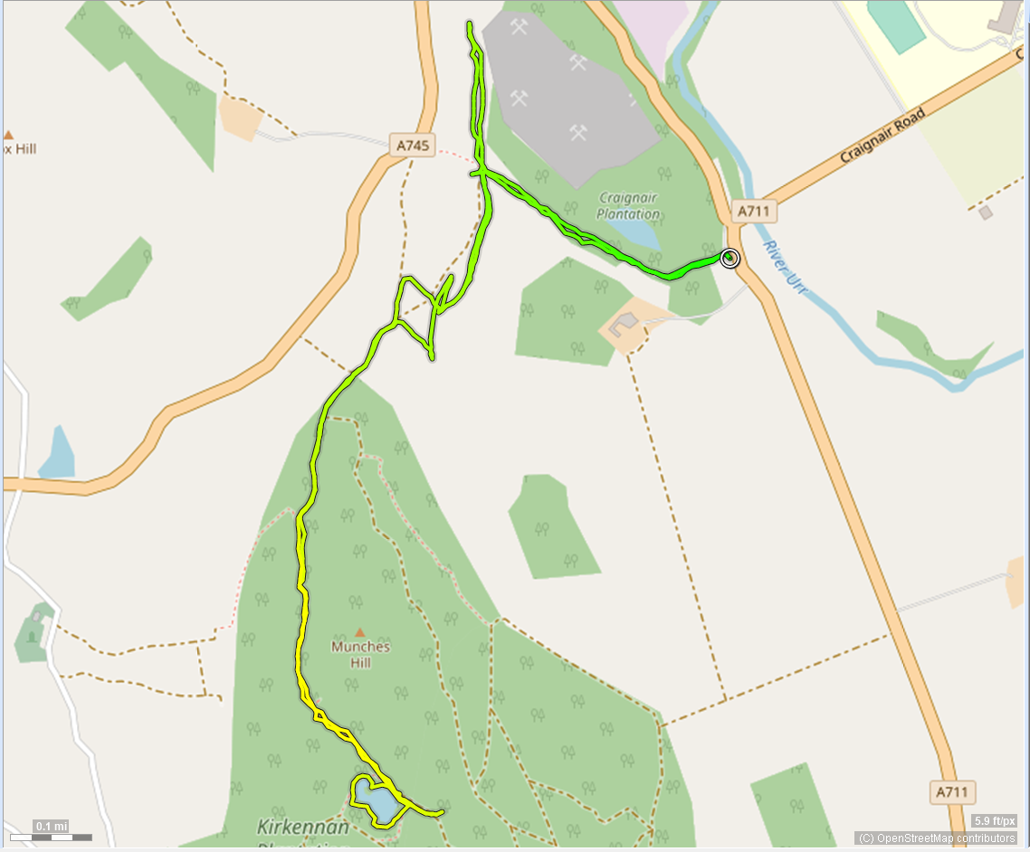 click to zoom - opens in new window
kirkennan woodlands ~3 miles
The Munches Hills or Kirkennan woodlands hold Gavin's Loch (walk above) and offers walking along steep forest roads. This walk starts from a small car park on the A710 opposite the entrance to Kirkennan Estate. This car park is often shut and parking is limited on the verge and you should take care if parking there. The route follows established roads climbing all the way. The first loop To the summit is "off track". It can be a tricky wlak through the felled tree remains, but in my opinion the views are well worth it. Please take care.
Download the GPX file for this walk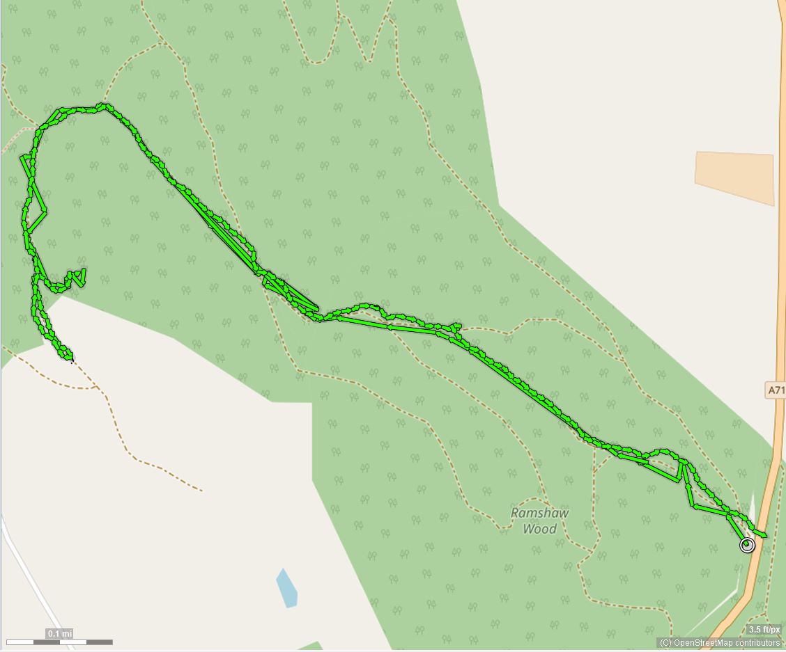 click to zoom - opens in new window
kippford to rockcliffe circular 1 ~2.75 miles
This walk starts at Kippford car park and takes a circular route to Rockcliffe and back via part of the Woodpecker walk. Plenty of opportunity to go "off-piste" (WITH CARE) and enjoy the views and beaches as well as the woodlands.
Download the GPX file for this walk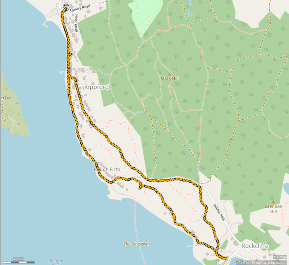 click to zoom - opens in new window
muckle walk ~ 3 miles
You can get a bus to Rockcliffe or drive and park in the Council Car Park. Muckle Walk takes you through pleasant forest on the forest tracks until you reach a fantastic viewpoint for views over the Solway Firth towards Cumbria. While most of the walk is on well-maintained forest roads, the route back from the viewpoint is more challenging albeit all downhill.
Download the GPX file for this walk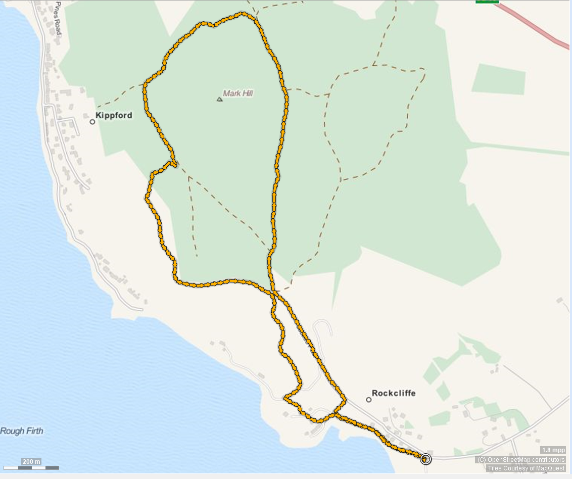 click to zoom - opens in new window
woodpecker ~1.5 miles
Bus or park at Rockcliffe. Past toilets on your right, turn right up lane, through 2 gates. Follow the path over a footbridge through the field to a display board. Follow the path across the field to a gate, and on through further gates. You'll pass the Mote of Mark on your left which offers great views on a clear day. Follow the path past the woodcarving of the woodpecker to the Jubilee path. Follow towards Kippford looking out after about 1/2 mile for a large stone on your left with a white arrow. Follow the path back to the shore and the car park. This map shows a slight detour onto one of the rocky outcrops for a lovely view
Download the GPX file for this walk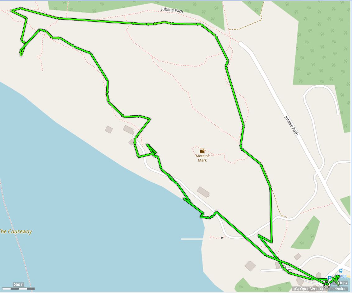 click to zoom - opens in new window
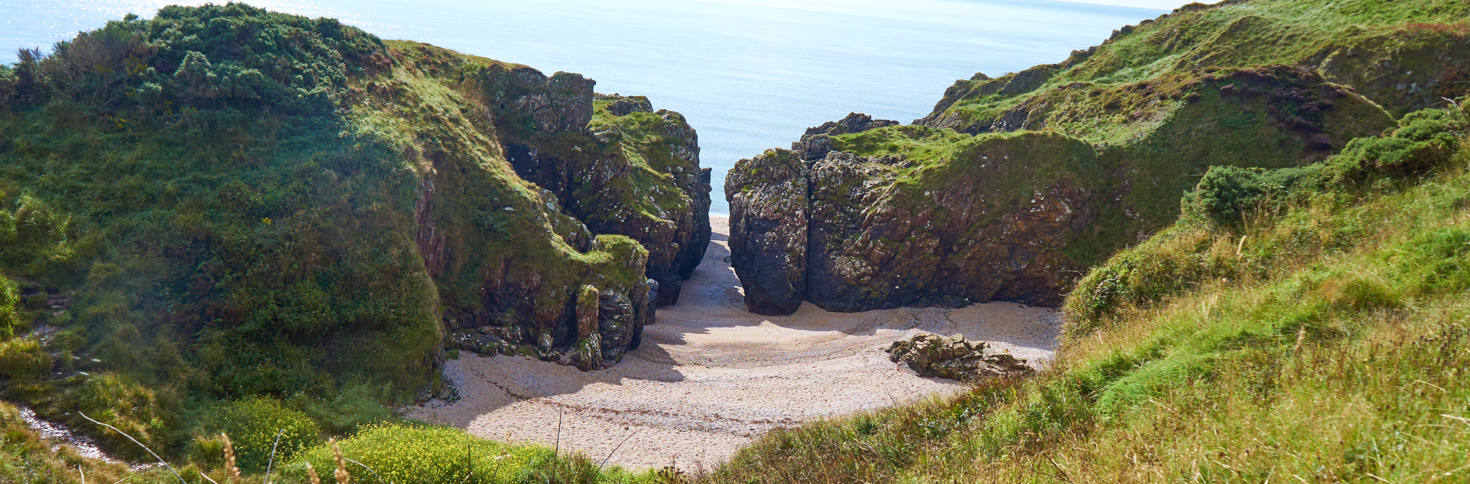
cutcher's isle ~ 3.5 miles
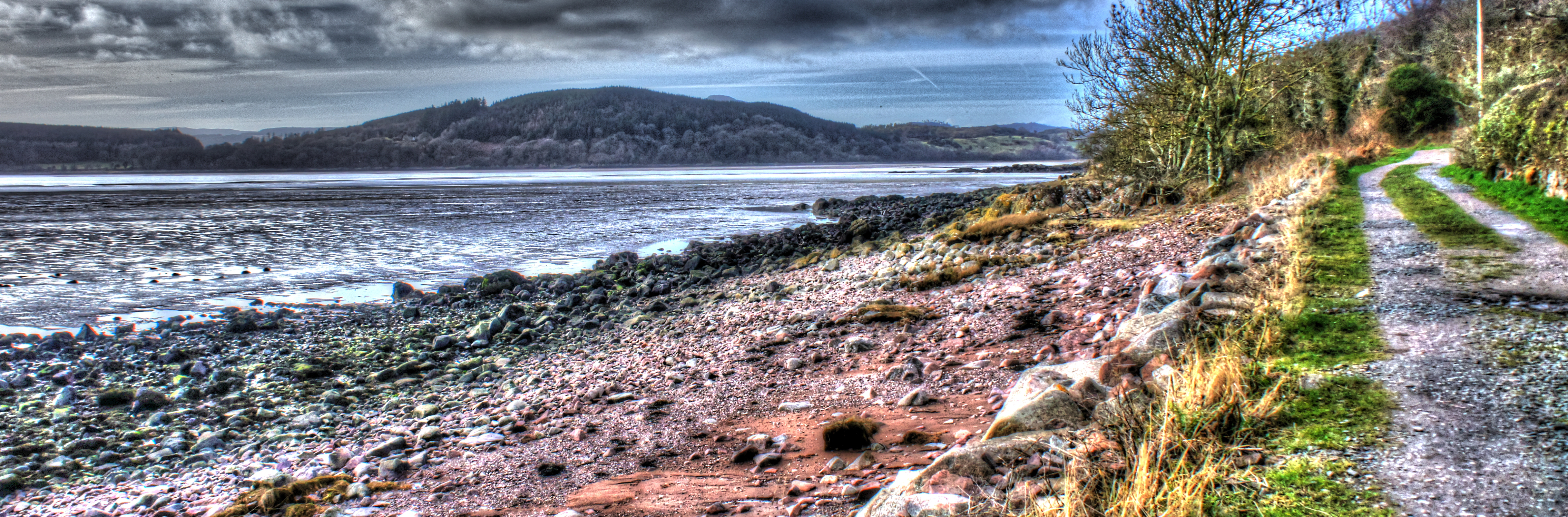
You can get a bus to Rockcliffe or drive and park in the Council Car Park. The walk is part of the Coastal Path walk and takes in Castle Point, a lovely view point. The first part is relatively flat, and offers lovely views of Rockcliffe, Hestan and Rough Isles, and across the estuary to Screel. You might even see the Isle of Man in the distance! The second part is more challenging (from Castle Point) but Cutcher's Isle is a magical bay and a great picnic spot on a nice day. The Coastal Walk continues to Sandyhills and will be shown in following updates.
Download the GPX file for this walk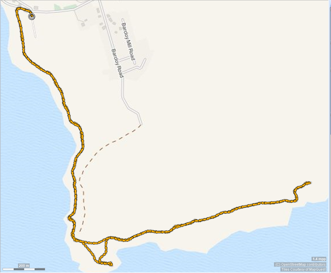 click to zoom - opens in new window
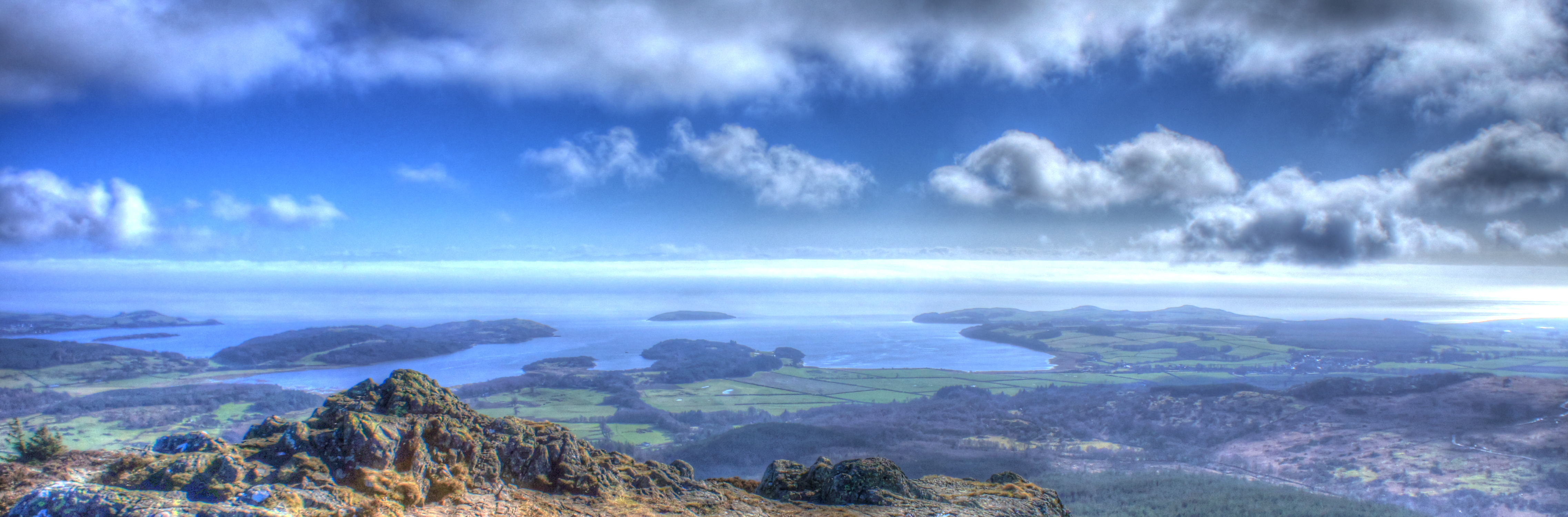
screel 344 metres high
Screel has to be one of the most rewarding relatively short hill walks in Scotland! There is a good path from the small car park up to the wooded area. Through that an to the summit is a well--establsihed path, but there are some steep and narrow parts. The trail along the summit to the Cairn can be boggy, but the views on a clear day are more than worth it. Intrepid walkers can continue across Midhill to Bengairn, higher than Screel, but that is not shown here. Continue on the trail down some challenging stream beds to the path that links to the forest road for a leisurley walk back, still with stunning views until the seat at the "crossroads" you passed on the way up. Follow the path back to the car park. There is a longer route along the forest roads on the way up, and even if you have just the energy to make it to the bench the views from there across the Solay Firth are worthwhile.
Download the GPX file for this walk click to zoom - opens in new window
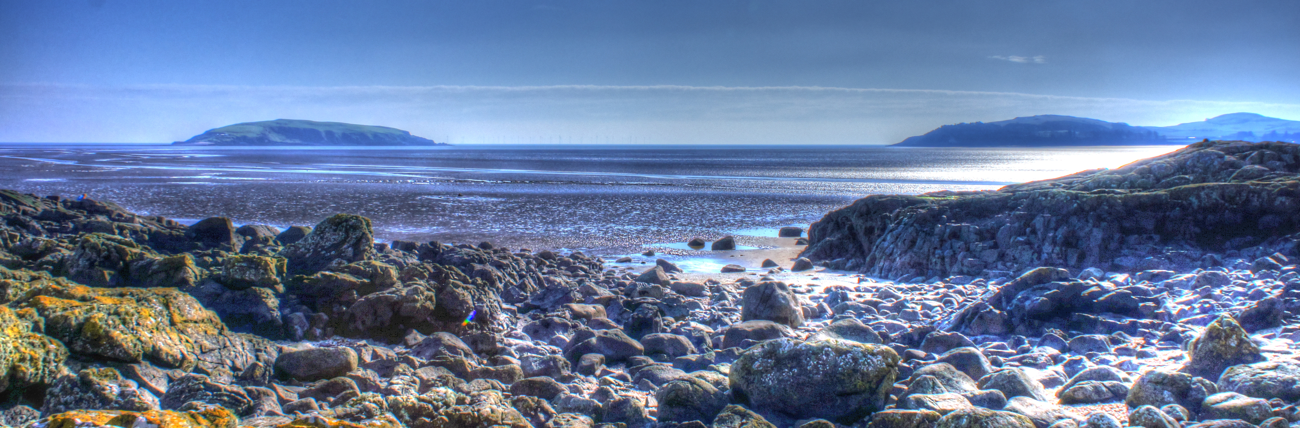
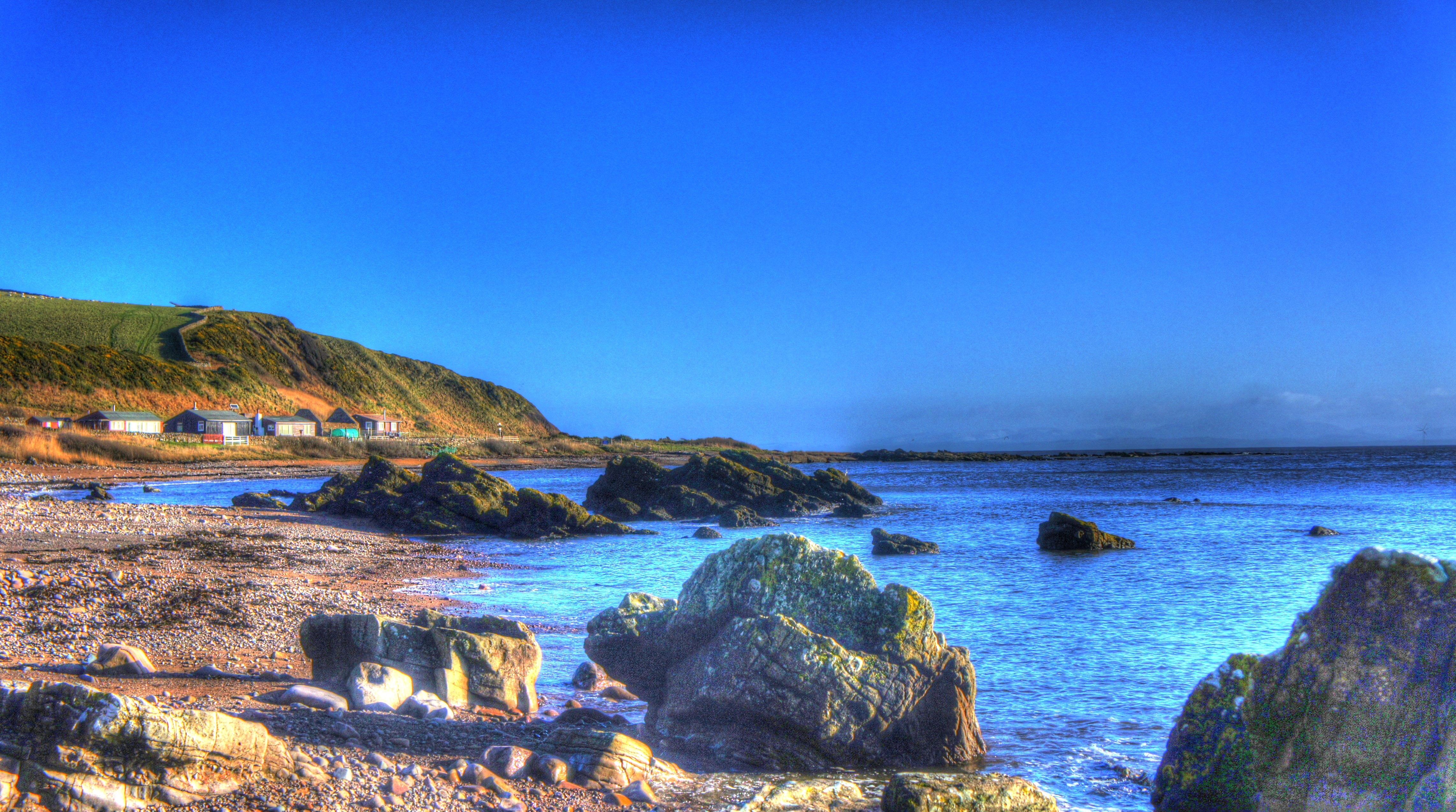
auchencairn torr point circular ~3 miles
Park at the car park by the bowling club. Walk back along the road and through the lovely community garden, over the bridge, turn right. Follow the path by the river and through the gates. As you come to the Merse you can stop off at the "Bird Hide". Back on the path follow along the Merse, some sections are boardwalks, not always in perfect condition till you pass through a rickety gate near a house. Turn right through the gate and follow the road tracks to Torr Point. Lovely views of Hestan and the Solway Firth. You can detour to red haven beach before Torr point (not on this map). Walk back from Torr Point, turn right at the sign and follow the path through fields and woodlands until you arrive bak at the road, turn left. Follw to the house and turn right back along the Merse path to Auchencairn.
Download the GPX file for this walk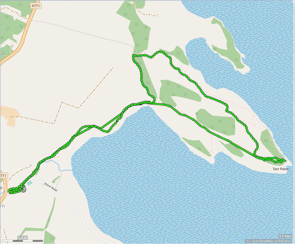 click to zoom - opens in new window
balcary bay rascarrel circular ~5 miles
Park at the car park just past the entrance to the Balcary Bay Hotel. The walk can be taken either way, the walk taken here follow the farm track at the North end of the car park. https://www.dalbeattie.org.uk/GPX-tracks/BalcaryBay_Rascarrel.png Continue following the route shown which will take you to Rascarrel Bay and return you via the Cliffs to Balcary Bay. Great care should be taken along the narrow cliff top path, which is single file for some distance. However the views are spectacular. The walk is aprroximatley 5 miles and you should allow a couple of hours.
Download the GPX file for this walk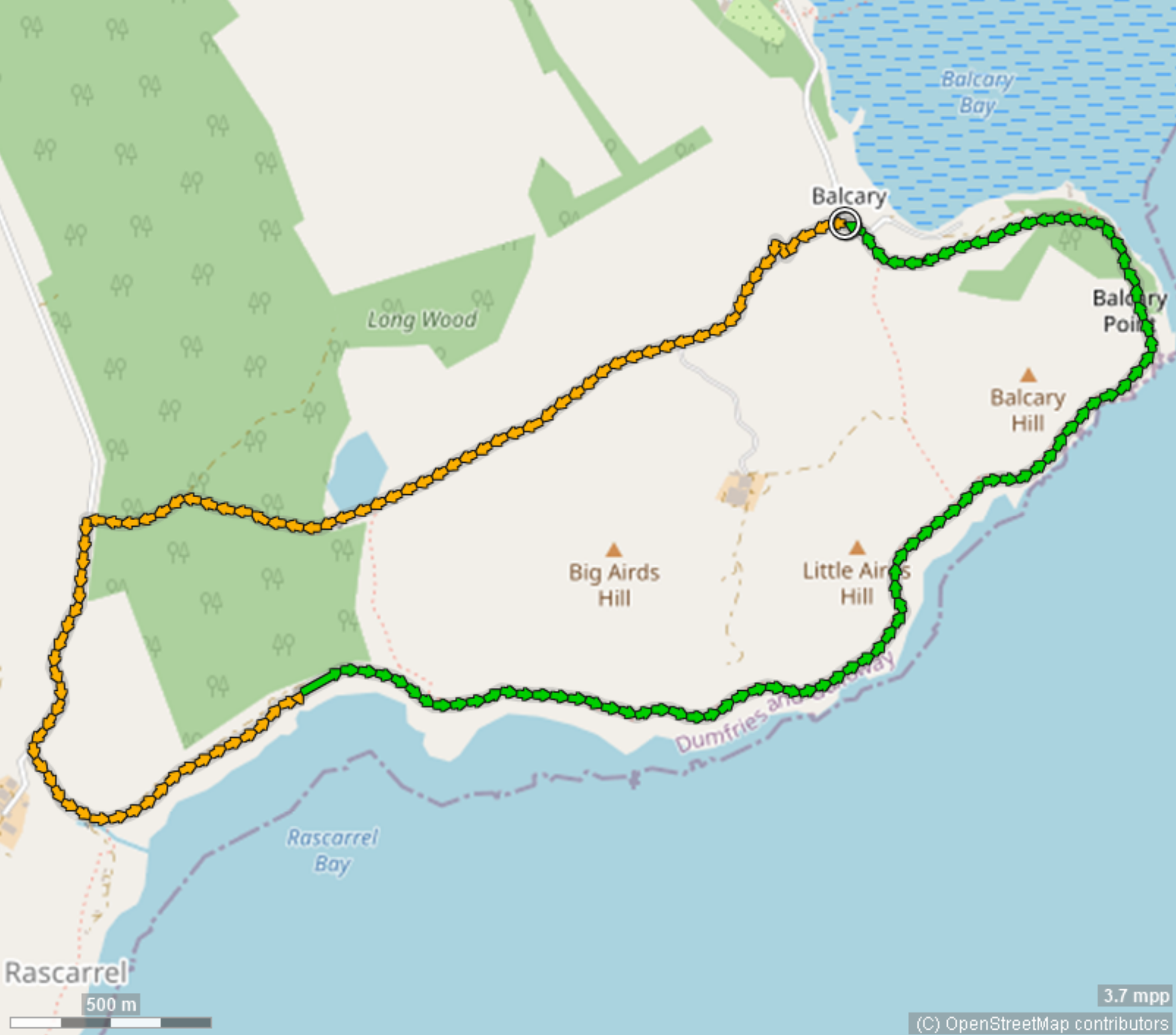 click to zoom - opens in new window
doach ~1.5 miles
To get to Doach by road, take the A711 towards Castle Douglas from Dalbeattie, and follow it towards Auchencairn, past Palnackie and then the B736. The Forestry signs are about a mile on the right. There is parking but no other facilities. The track has been improved and starts off pretty much flat until you reach the limit of the wood and have to turn left. The path ascends rapidly and you should take the spur to the viewpoint at the very top. It is well worth it for the views, especially if you strike lucky with the weather.
Download the GPX file for this walk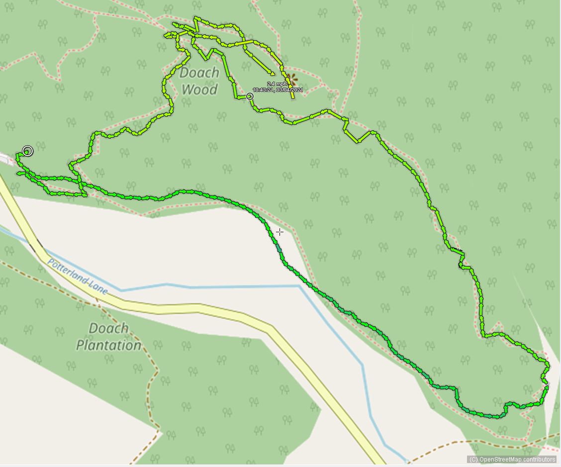 click to zoom - opens in new window
waterloo monument - new abbey ~3 miles
The walk to Waterloo Monument is strenuous - the second half being a steep incline. My version starts from the car park next to Sweetheart Abbey in New Abbey. There's a tearoom, pub and shops in the Village (check opening times). Walk through the Village past the Abbey Arms to the Pond and foillow the signs from there. On a clear day the views from the Monument are spectacular. The GPX track has the route up. You can retrace your steps back down. Take care on this walk.
Download the GPX file for this walk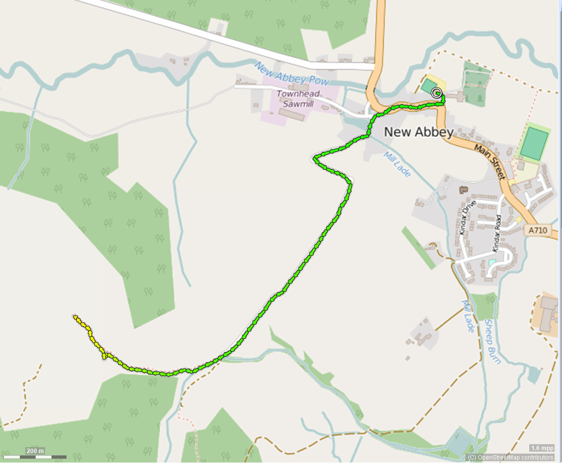 click to zoom - opens in new window
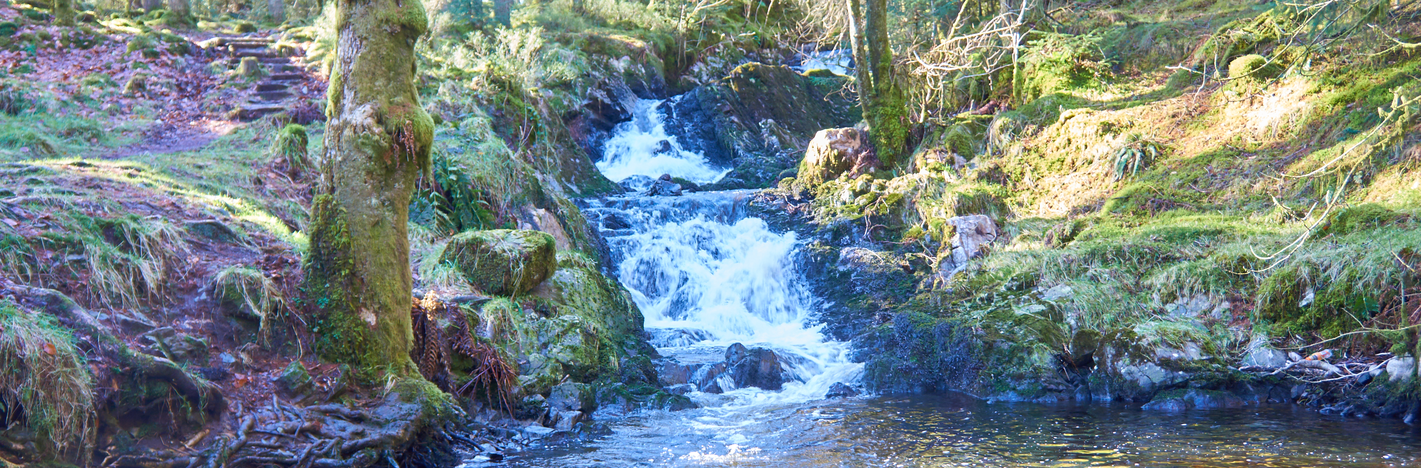
kennick burn laurieston ~1 mile
Kennick Burn is a mile long walk through forest with half the walk alongside the Kennick Burn (River). Although a short walk it's second half along the river is sparkling on a sunny day. From Laurieston take the "C" road towards Gatehouse of Fleet and find Parking about a mile on the left
Download the GPX file for this walk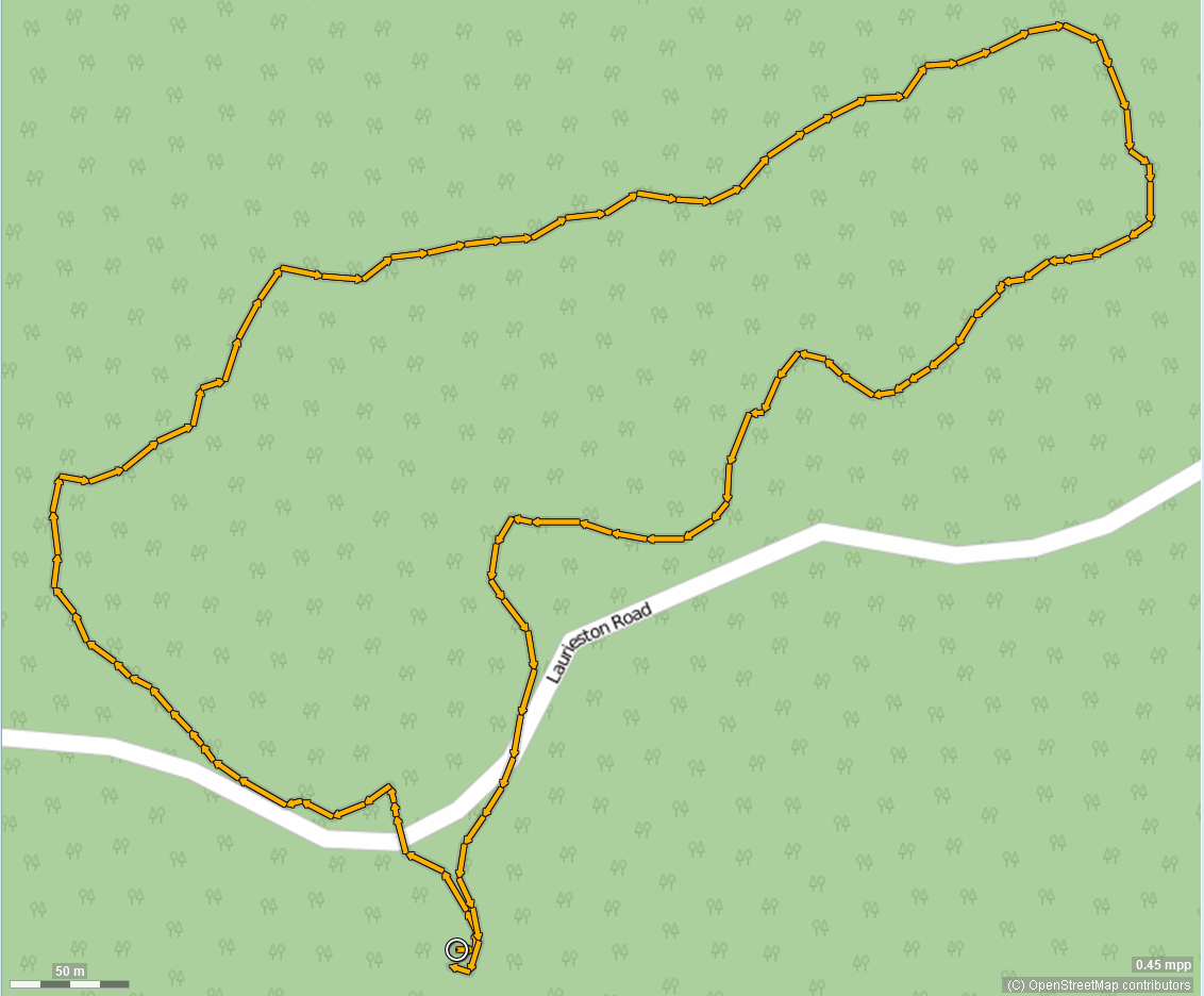 click to zoom - opens in new window
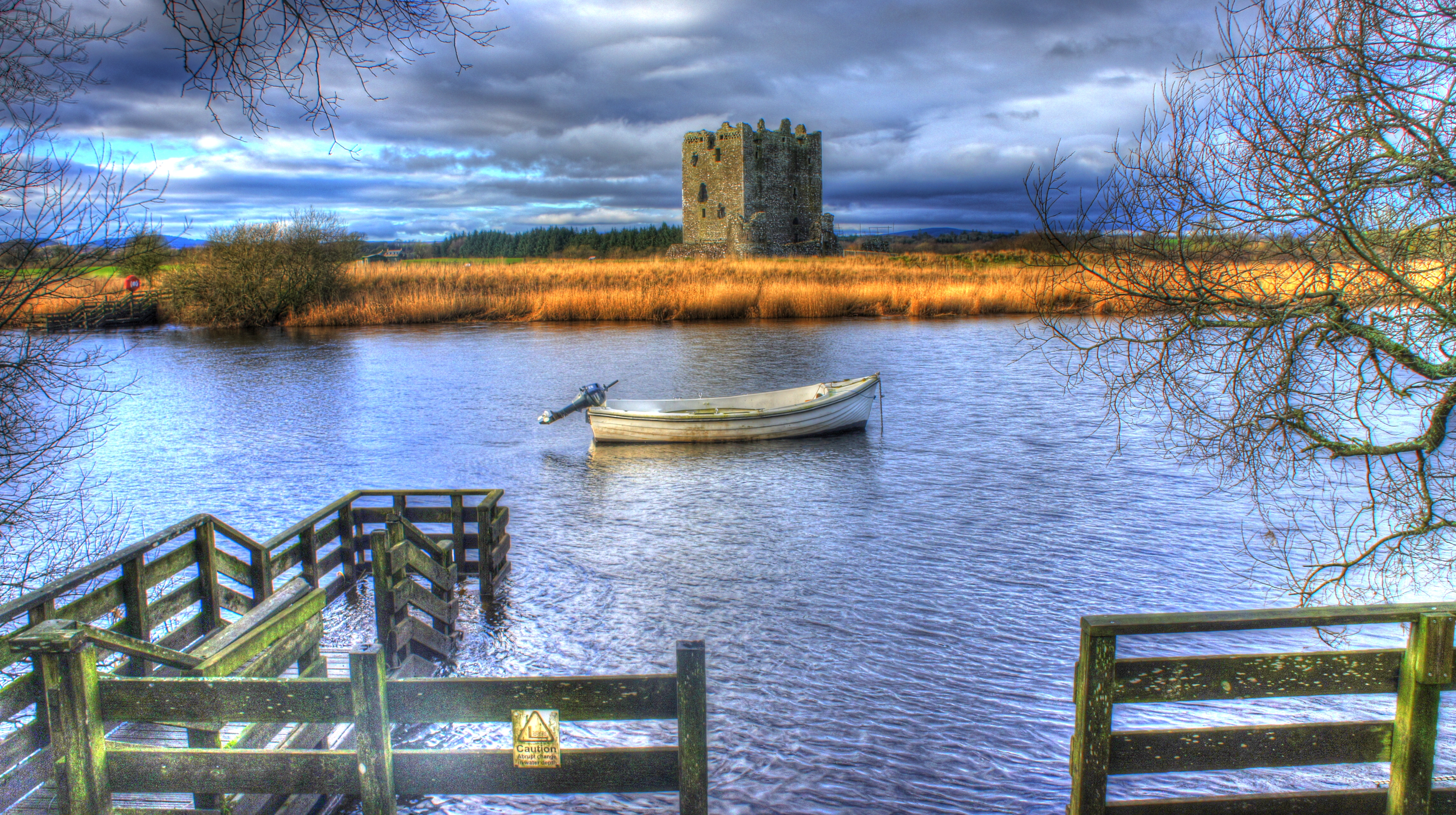
threave walk 1 ~3 miles
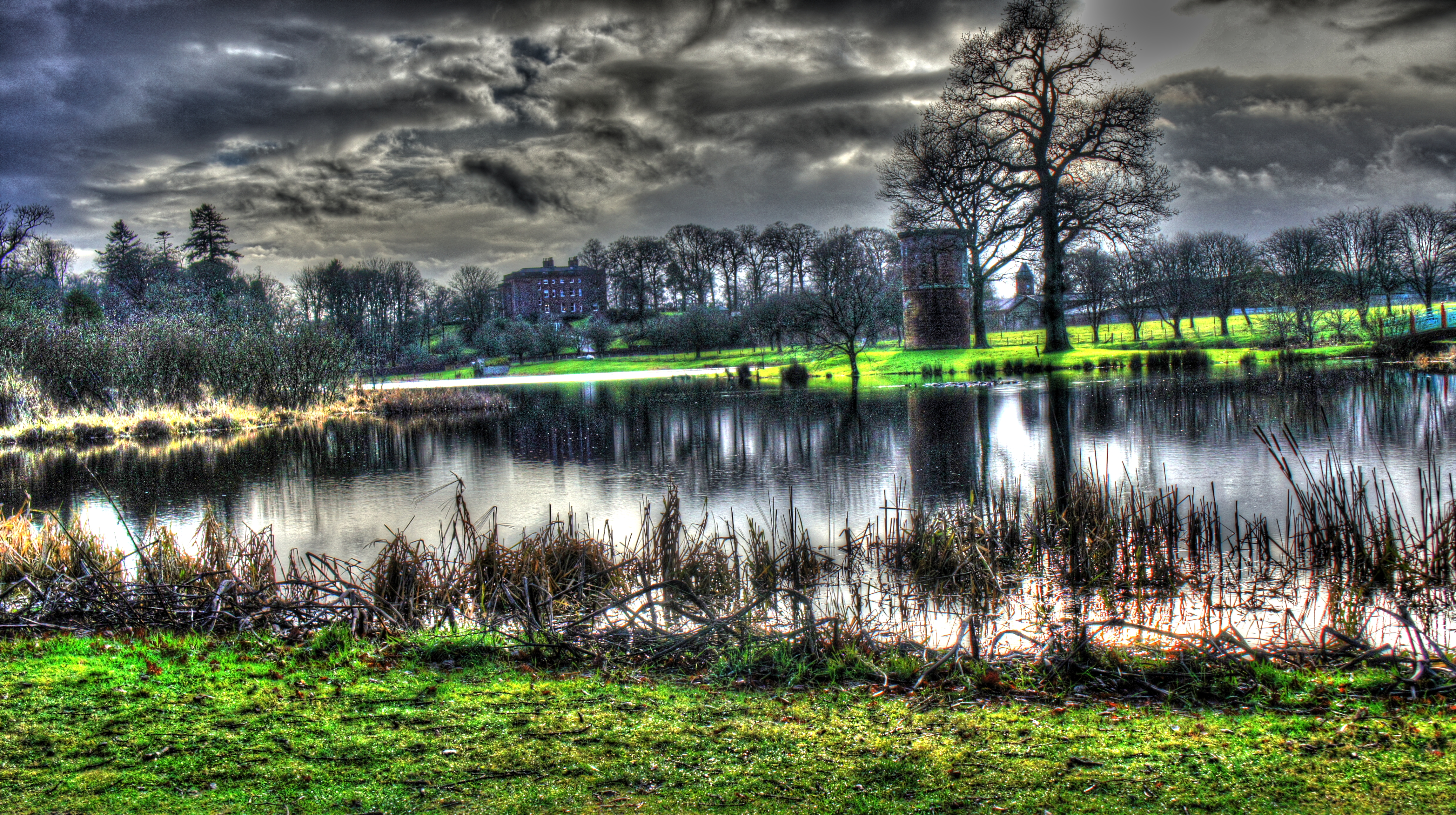
Thanks to late 2021 storms and Threave works take care when you walk at Threave. Picture of the Castle taken on the walk December 2021
Download the GPX file for this walk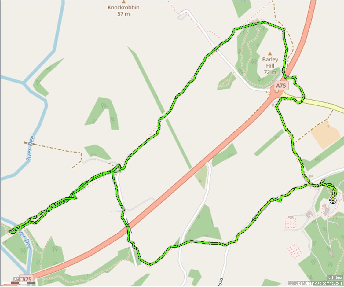 click to zoom - opens in new window
turners monument ~2.5 mile
The walk to the Turner monument is on one of several hills in the Region known as Bennan, and not to be mistaken with others, This one is accessed fron the Kirkpatrick Durham to Glenkiln road at Glen. The approximate co-ordinates are 55.06129881150993, -3.8389524953374057. The road trip itself is worthwhile if you don't mind single track roads. A short (about a mile) steep ascent along a forest road leads to a poorly marked final climb over boggy ground. But the views are well worth it!. The walk is circular but I've just shown return by the same route to the tiny parking area at the start.
Download the GPX file for this walk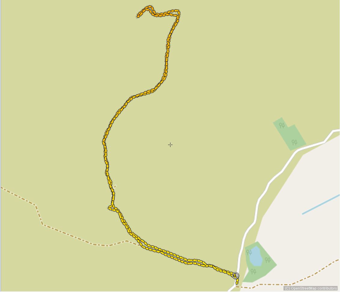 click to zoom - opens in new window
litte dornell ~4.7 miles miles
From Balmaghie Kirk car park. Another very rewarding walk (especially if the weather is clear) along tarmac first then forest tracks. Some steeper stages to get to the top, the final 25 metres is a track. 365 degree view to two of the Galloway Cairnsmores - Fleet and Carsphairn, Screel and further if it's very clear. Well worth the effort.
Download the GPX file for this walk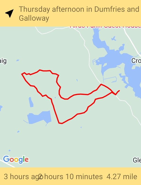 click to zoom - opens in new window
loch trool circular ~7 miles
There's a raft of well-signposted walks in Glentrool. I know it's a way further West of Dalbeattie and Castle Douglas but I don't think I can leave them out. This is the first of what I expect will be a longer selection, including Merrick. Go past the visitor centre and follow the single track road for about a mile then turn right to the car park. The circular walk offers plenty of lovely views and takes you past "bruce's Stone", a great place fo a rest and enjoy the view.
Download the GPX file for this walk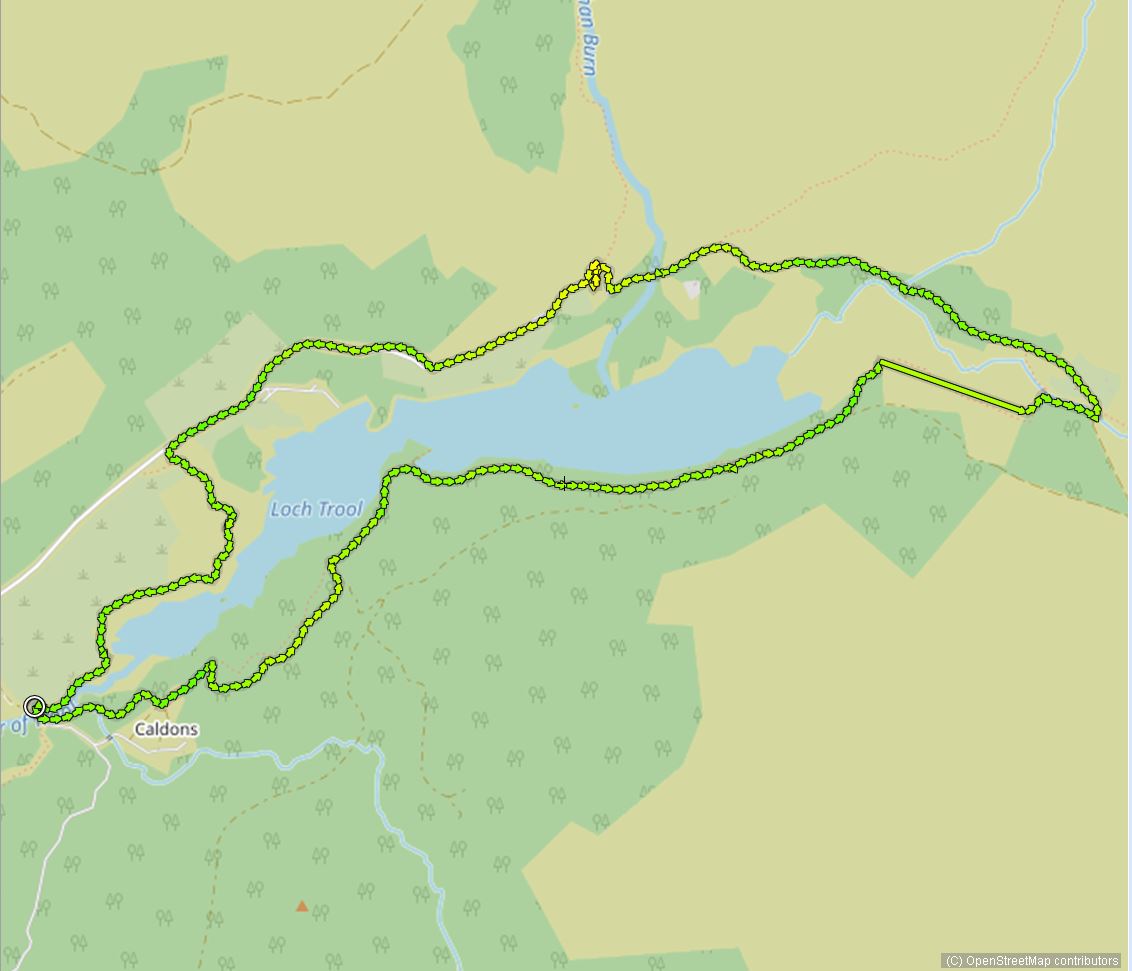 click to zoom - opens in new window
gatehouse to sandgreen ~7 miles
Starting from the main Gatehouse of Fleet car park this walk takes you through part of Garries Park, Cally Palace Estate and then along a ridge to the bay of Sandgreen. Lots of lovely views of the Solway Coast,a s well as the carefully tended grounds of Cally. Sandgreen Bay is a treat. The round trip is about 7 miles, and ending back in the carpark means easy access to café's and pubs! Good roads and not much elevation makes this a walk for many.
Download the GPX file for this walk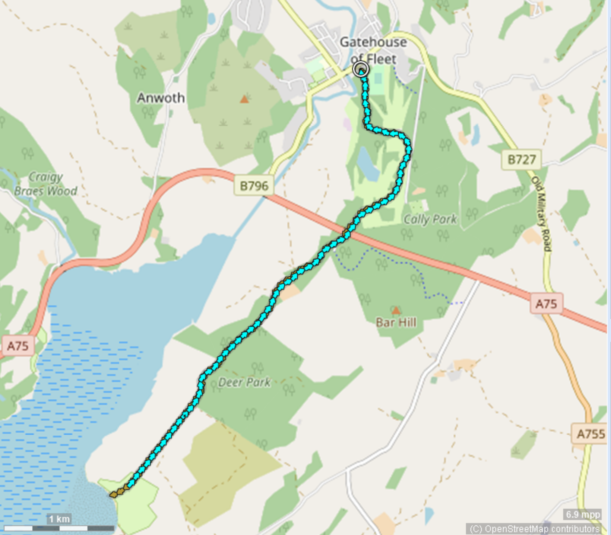 click to zoom - opens in new window
dalswinston estate ~4.25 miles
We're lucky that many landowners not only observe the "right to roam" provisions in Scotland but help out with parking and signange. Dalswinston is a lovely Estate with lots to see on this version of the circular walk. You should park at the red church car park and do the walk from there.
Download the GPX file for this walk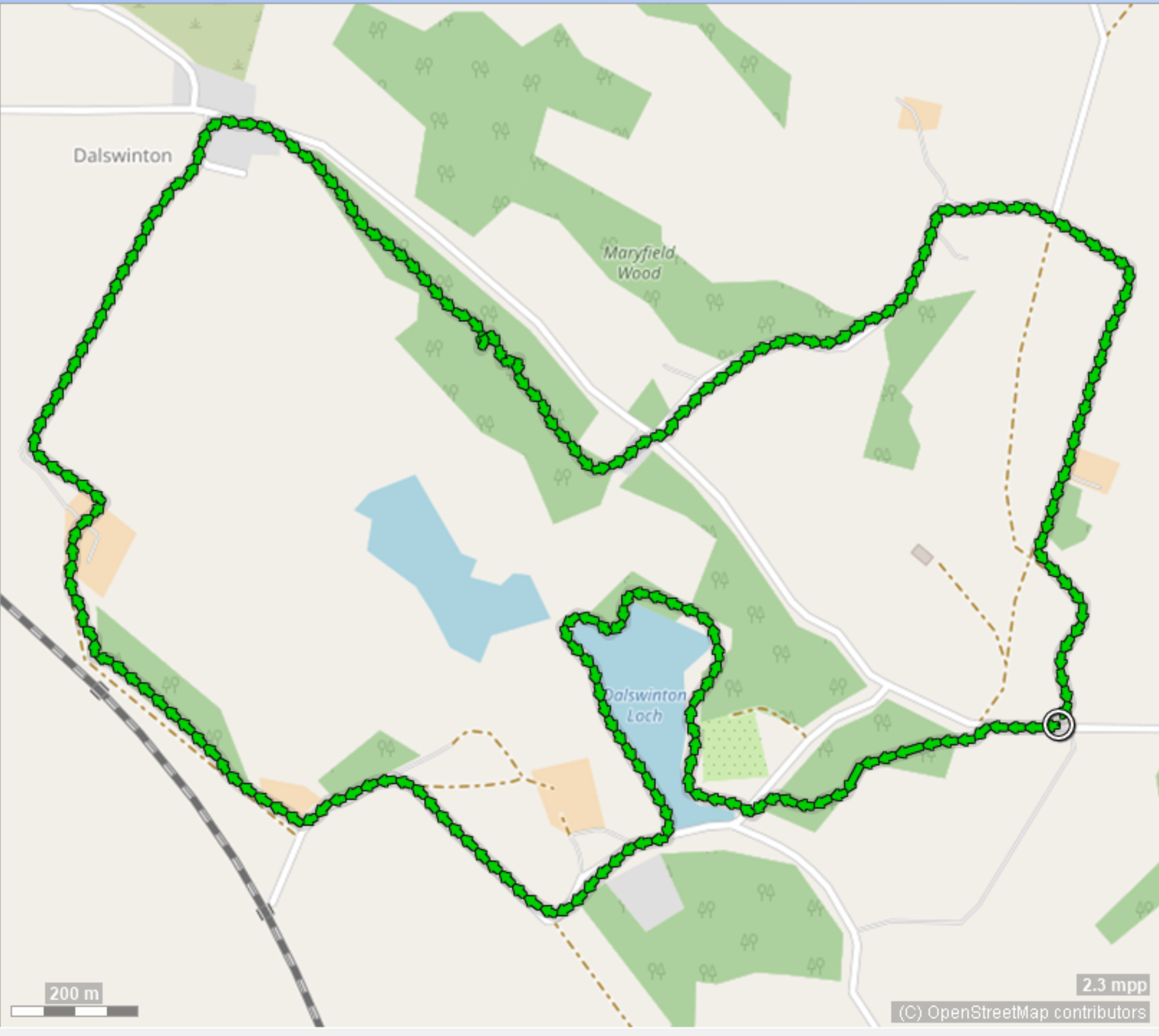 click to zoom - opens in new window